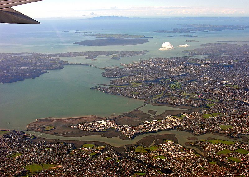
Image: Waitematā Harbour Eastwards View

Size of this preview: 800 × 571 pixels. Other resolutions: 320 × 228 pixels | 3,098 × 2,211 pixels.
Original image (3,098 × 2,211 pixels, file size: 5.56 MB, MIME type: image/jpeg)
Description: An eastwards view over the Waitematā Harbour, New Zealand. Waitakere City below, North Shore City at the left, Auckland City and Rangitoto Island in the middle distance, with Great Barrier Island and the Coromandel visible in the far distance in the Hauraki Gulf. Taken en route from Auckland International to Port Vila.
Title: Waitematā Harbour Eastwards View
Credit: Auckland, New Zealand, 31 May 2006
Author: Phillip Capper from Wellington, New Zealand
Usage Terms: Creative Commons Attribution 2.0
License: CC BY 2.0
License Link: https://creativecommons.org/licenses/by/2.0
Attribution Required?: Yes
Image usage
The following page links to this image:

All content from Kiddle encyclopedia articles (including the article images and facts) can be freely used under Attribution-ShareAlike license, unless stated otherwise.
