Image: WI-Wauwatosa-1892

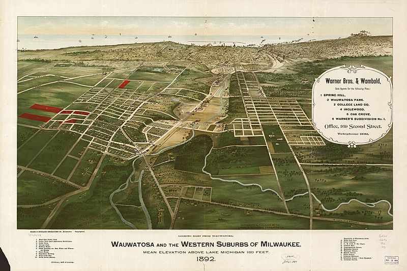
Description: 1892 aerial map of Wauwatosa, Wisconsin, looking east toward Milwaukee and Lake Michigan. The Menomonee River flows east into Lake Michigan, while Honey Creek flows north into the Menomonee. State Street runs parallel to the Menomonee River on its north bank. Wisconsin Avenue and Bluemound Road cross Honey Creek in the right foreground.
Title: WI-Wauwatosa-1892
Credit: This image is available from the United States Library of Congress's Geography & Map Division under the digital ID g4124w.pm010650. This tag does not indicate the copyright status of the attached work. A normal copyright tag is still required. See Commons:Licensing for more information. العربية | čeština | Deutsch | English | español | فارسی | suomi | français | magyar | italiano | македонски | മലയാളം | Nederlands | polski | português | русский | slovenčina | slovenščina | Türkçe | українська | 中文 | 中文(简体) | 中文(繁體) | +/−
Author: Marr & Richards Engraving Co.
Usage Terms: Public domain
License: Public domain
Attribution Required?: No
Image usage
The following page links to this image:

