
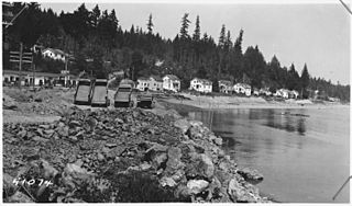
Image: View shows in foreground rock fill slope protection at about Sta.75. Line of high stakes at toe of fill slope low... - NARA - 298221

Size of this preview: 800 × 470 pixels. Other resolutions: 320 × 188 pixels | 3,000 × 1,762 pixels.
Original image (3,000 × 1,762 pixels, file size: 1.16 MB, MIME type: image/jpeg)
Description: Scope and content: Federal highway file for Primary State Highway No. 21, Tidewater Creek to Bremerton Section.
Title: View shows in foreground rock fill slope protection at about Sta.75. Line of high stakes at toe of fill slope low tide. Existing road at left and in background.
Credit: U.S. National Archives and Records Administration
Author: Unknown or not provided
Usage Terms: Public domain
License: Public domain
Attribution Required?: No
Image usage
The following page links to this image:

All content from Kiddle encyclopedia articles (including the article images and facts) can be freely used under Attribution-ShareAlike license, unless stated otherwise.