
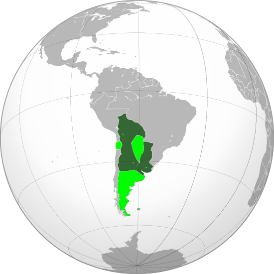
Image: Viceroyalty of the Río de la Plata (orthographic projection)

Description: Location of the Viceroyalty of the Río de la Plata in orthographic projection, approx. 1796. Sovereign territory. Territories claimed.
Title: Viceroyalty of the Río de la Plata (orthographic projection)
Credit: Own work, based on the Image:Brazil (orthographic projection).svg, created by the Wikimedia Commons user Ssolbergj, under a Creative Commons Licence. Boundaries based in the following sources: Guyanas, Brazil-La Plata, Patagonia: File:Mapa_Geografico_de_America_Meridional_(1790).jpg United States: File:United_States_1798-1800-07-04.png New Granada: File:Nuevo Reino Granada.jpg, File:Mapa del Virreinato de Nueva Granada.png
Author: Keepscases
Permission: I, the copyright holder of this work, hereby publish it under the following license:
Usage Terms: Creative Commons Attribution 3.0
License: CC BY 3.0
License Link: https://creativecommons.org/licenses/by/3.0
Attribution Required?: Yes
Image usage
The following page links to this image:

.svg)