
Image: Vettones cities location map-es

Size of this PNG preview of this SVG file: 600 × 600 pixels. Other resolution: 240 × 240 pixels.
Original image (SVG file, nominally 1,900 × 1,900 pixels, file size: 1.96 MB)
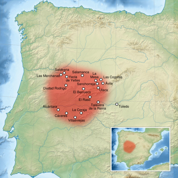
Description: Map of Vettones main cities and territory, in the Iberian Peninsula. Translation to spanish language of the french map File:Vettones cities location map-fr.svg (Toledo and Salamanca instead of Toléde, Salamanque) and small corrections to toponyms (Ulaca instead of Ucala, Yecla de Yeltes instead of Yecta) and locations.
Title: Vettones cities location map-es
Credit: This file was derived from: Vettones cities location map-fr.svg by Sémhur
Author: Asqueladd
Usage Terms: Creative Commons Attribution-Share Alike 3.0
License: CC BY-SA 3.0
License Link: https://creativecommons.org/licenses/by-sa/3.0
Attribution Required?: Yes
Image usage
The following page links to this image:

All content from Kiddle encyclopedia articles (including the article images and facts) can be freely used under Attribution-ShareAlike license, unless stated otherwise.