
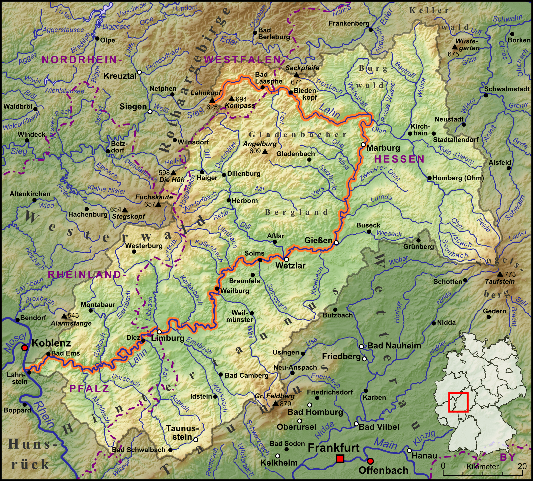
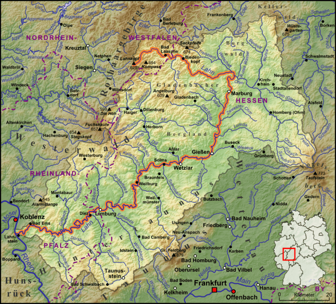
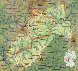
Image: Verlaufskarte Lahn
Size of this preview: 664 × 600 pixels. Other resolutions: 266 × 240 pixels | 2,101 × 1,897 pixels.
Original image (2,101 × 1,897 pixels, file size: 6.43 MB, MIME type: image/png)
Description: Die Lahn, ihre Nebenflüsse und das Wassereinzugsgebiet begrenzt durch die Wasserscheiden
Title: Verlaufskarte Lahn
Credit: own work, used: http://www.openstreetmap.org KMZ-Dateien der Flusssysteme von http://www.giersbeck.de Generic Mapping Tools mit SRTM3 V2-Daten
Author: Lencer
Usage Terms: Creative Commons Attribution-Share Alike 3.0
License: CC BY-SA 3.0
License Link: http://creativecommons.org/licenses/by-sa/3.0
Attribution Required?: Yes
Image usage
The following page links to this image:

All content from Kiddle encyclopedia articles (including the article images and facts) can be freely used under Attribution-ShareAlike license, unless stated otherwise.