
Image: Vega del Tajo
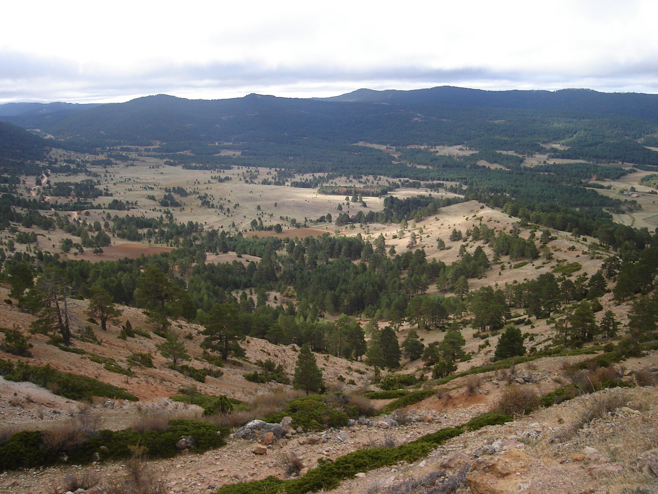
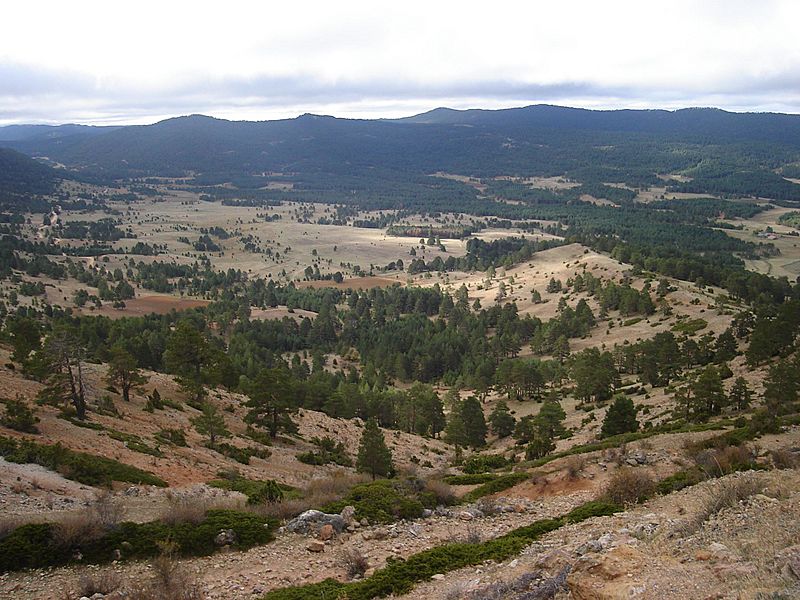
Description: Vega del rio Tajo desde el Puerto el Portillo (1790 m), en el término de Guadalaviar. Se encuentra dentro de los Montes Universales, entre la Sierra de Albarracin y la Serranía de Cuenca.
Title: Vega del Tajo
Permission: .mw-parser-output .responsive-license-cc{clear:both;text-align:center;box-sizing:border-box;width:100%;justify-content:space-around;align-items:center;margin:0.5em auto;background-color:#f9f9f9;border:2px solid #e0e0e0;border-spacing:8px;display:flex}.mw-parser-output .responsive-license-cc div{margin:4px}.mw-parser-output .rlicense-text div{margin:0.5em auto}@media screen and (max-width:640px){.mw-parser-output .responsive-license-cc{flex-flow:column}.mw-parser-output .rlicense-text{order:1}} This file is licensed under the Creative Commons Attribution-Share Alike 3.0 Unported license. You are free: to share – to copy, distribute and transmit the work to remix – to adapt the work Under the following conditions: attribution – You must give appropriate credit, provide a link to the license, and indicate if changes were made. You may do so in any reasonable manner, but not in any way that suggests the licensor endorses you or your use. share alike – If you remix, transform, or build upon the material, you must distribute your contributions under the same or compatible license as the original.https://creativecommons.org/licenses/by-sa/3.0CC BY-SA 3.0 Creative Commons Attribution-Share Alike 3.0 truetrue
Usage Terms: Creative Commons Attribution-Share Alike 3.0
License: CC BY-SA 3.0
License Link: https://creativecommons.org/licenses/by-sa/3.0
Attribution Required?: Yes
Image usage
The following 2 pages link to this image:
