
Image: Vallée de la Matapedia

Size of this PNG preview of this SVG file: 800 × 561 pixels. Other resolution: 320 × 224 pixels.
Original image (SVG file, nominally 1,152 × 808 pixels, file size: 1.35 MB)
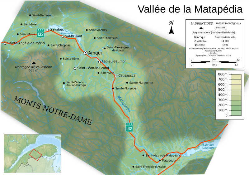
Description: Topographic map in French of en:Matapedia, Quebec, with 2006' census cities.
Title: Vallée de la Matapedia
Credit: Own work ; Sources of data: NASA SRTM30 (public domain); NGDC World Data Bank II (public domain); NGDC GSHHS (public domain); VMap-0 (public domain);
Author: Chicoutimi
Permission: User:Chicoutimi/Credits
Usage Terms: Creative Commons Attribution-Share Alike 4.0
License: CC BY-SA 4.0
License Link: https://creativecommons.org/licenses/by-sa/4.0
Attribution Required?: Yes
Image usage
The following page links to this image:

All content from Kiddle encyclopedia articles (including the article images and facts) can be freely used under Attribution-ShareAlike license, unless stated otherwise.