
Image: Utica Shale assessment - 01

Size of this preview: 774 × 600 pixels. Other resolutions: 310 × 240 pixels | 1,324 × 1,026 pixels.
Original image (1,324 × 1,026 pixels, file size: 662 KB, MIME type: image/jpeg)
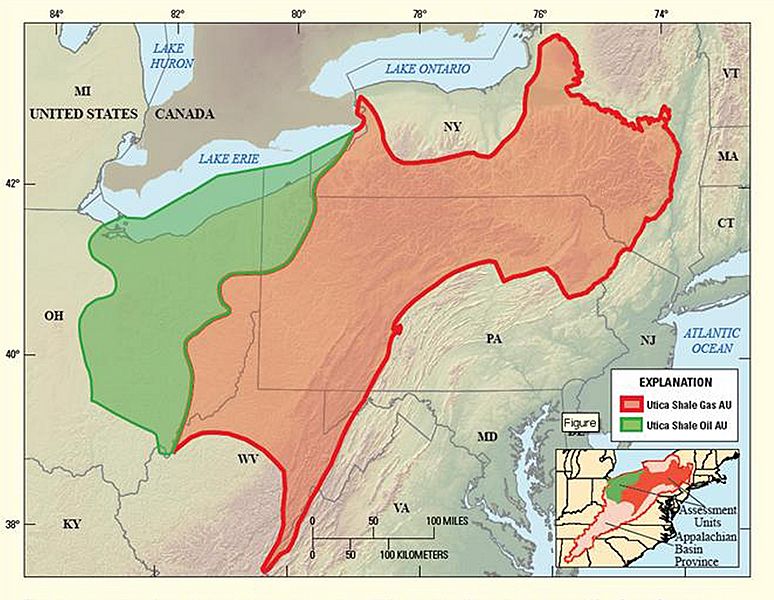
Description: Diagram showing the location of the oil and gas assessment units (AU) for the Utica Shale in the Appalachian Basin Province.
Title: Utica Shale assessment - 01
Credit: http://www.usgs.gov/newsroom/article.asp?ID=3419&from=rss_home#.UHjeP2_A9yc
Author: USGS
Usage Terms: Public domain
License: Public domain
Attribution Required?: No
Image usage
The following page links to this image:

All content from Kiddle encyclopedia articles (including the article images and facts) can be freely used under Attribution-ShareAlike license, unless stated otherwise.