
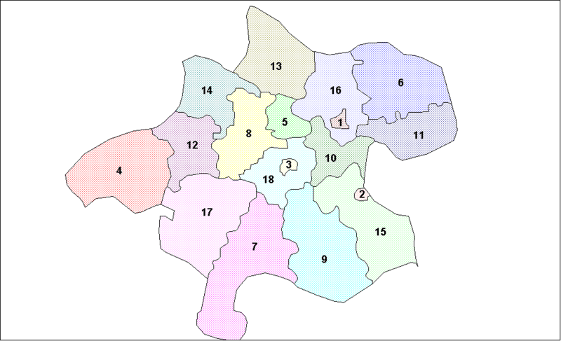
Image: Upper Austria Districts

Size of this preview: 800 × 487 pixels. Other resolutions: 320 × 195 pixels | 1,025 × 624 pixels.
Original image (1,025 × 624 pixels, file size: 21 KB, MIME type: image/png)
Description: Map of the districts of the State of Upper Austria in Austria. Created by Rarelibra for public domain use. Created using MapInfo Professional v7.5 and various mapping resources.
Title: Upper Austria Districts
Credit: Own work Transferred from en.wikipedia
Author: Rarelibra at en.wikipedia
Usage Terms: Public domain
License: Public domain
Attribution Required?: No
Image usage
The following page links to this image:

All content from Kiddle encyclopedia articles (including the article images and facts) can be freely used under Attribution-ShareAlike license, unless stated otherwise.