
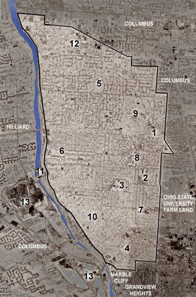
Image: Upper Arlington, Ohio satellite map

Description: Color-modified satellite image of satellite image of Upper Arlington, Ohio. Municipal borders are marked in white; the blue line marks the Scioto River, along which Riverside Drive, Upper Arlington's western border follows. Key to map: Upper Arlington Municipal Services Center Upper Arlington High School Northam Park and main Upper Arlington Public Library Miller Park and library branch Lane Road Park and library branch Fancyburg Park Lane Avenue Shopping Center Kingsdale Shopping Center Ohio State University Golf Course Scioto Country Club Griggs Reservoir AOL office (former Compuserve corporate headquarters) Quarries
Title: Upper Arlington, Ohio satellite map
Credit: United States Geological Survey
Author: United States Geological Survey, color modifications, municipality borders, and labels added by User:Postdlf
Usage Terms: Public domain
License: Public domain
Attribution Required?: No
Image usage
There are no pages that link to this image.
