
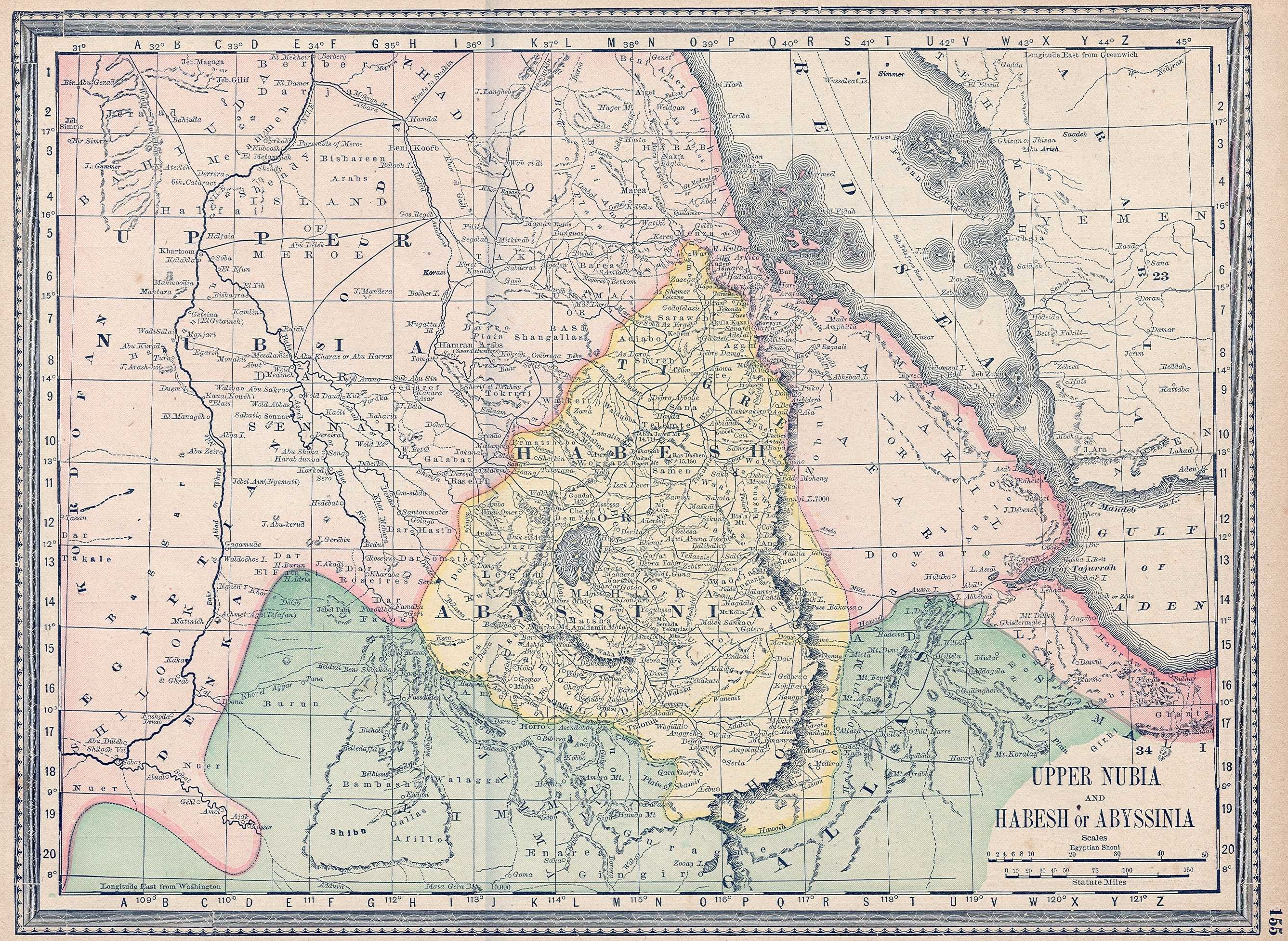
Image: UpperNubiaAndAbyssinia1891map
Description: Map of a portion of Northeast Africa in the early 1880s, from Rand McNally and Co.'s fourth edition of "Indexed Atlas of the World", published in 1882 and reproduced in subsequent editions. Shown in pink is the southern part of the ephemeral Egyptian empire in the Sudan and East Africa. Egyptian Khedive Isma'il Pasha (1863-1879), already in control of the Sudan, had imperial ambitions in East Africa. Egyptian armies occupied the Upper Nile Valley (Upper Nubia) and the southern Red Sea ports in the mid-1860s, and by 1875 they were in occupation of the entire coast from Suez to Cape Gardafui at the eastern tip of Africa, with garrisons in the Red Sea port as well as in Zeila, Bulhar, Berbera, Tadjoura. The Mahdi Uprising in the Sudan during the first half of the 1880s put an end to that ephemeral empire and by 1885 the Egyptians had evacuated all the areas shown on the map as well as all of the Sudan. They were immediately replaced by the Italian (Italian Eritrea), the French (French Somaliland) and the British (British Somaliland).
Title: UpperNubiaAndAbyssinia1891map
Credit: http://www.rare-maps.com/details.cfm?type=maps&rid=1450109
Author: Rand McNally and Co.
Usage Terms: Public domain
License: Public domain
Attribution Required?: No
Image usage
The following page links to this image:
