
Image: United States 1850-1853-03

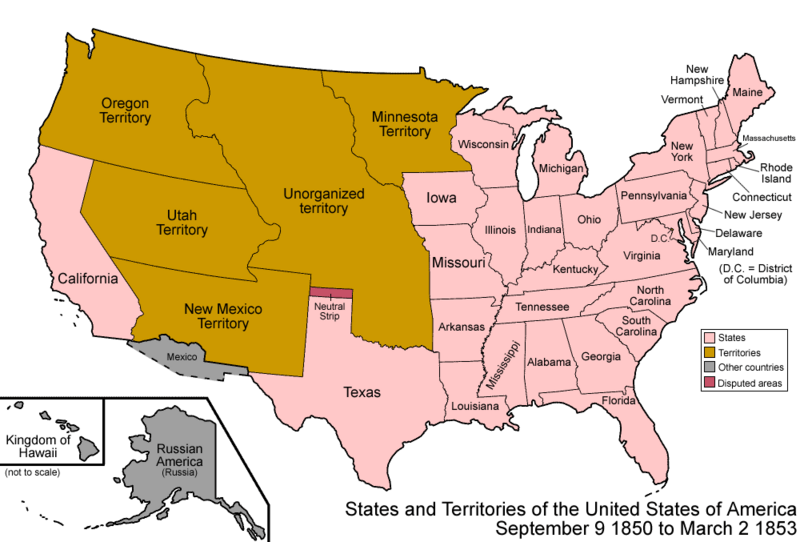
Description: Map of the states and territories of the United States as it was from 1850 to March 1853. On September 9 1850, several western areas changed: The Mexican Cession was organized, being split in to Utah Territory and New Mexico Territory, and one portion was admitted as the state of California. These two territories also included a portion of Texas, ceded to the federal government. Finally, a small area known as the Neutral Strip as not officially included in any state or territory. A small portion of Texas and the Mexican Cession became unorganized land. On March 2 1853, Washington Territory was split from Oregon Territory.
Title: United States 1850-1853-03
Credit: Own work
Author: Made by User:Golbez.
Permission: Own work, attribution required (Multi-license with GFDL and Creative Commons CC-BY 2.5)
Usage Terms: Creative Commons Attribution 2.5
License: CC BY 2.5
License Link: http://creativecommons.org/licenses/by/2.5
Attribution Required?: Yes
Image usage
The following 12 pages link to this image:
- Compromise of 1850
- Henry Clay
- History of California
- Immigration policy in Texas
- List of territorial claims and designations in Colorado
- Outline of Wyoming territorial evolution
- Southwestern United States
- Territorial evolution of Arizona
- Territorial evolution of California
- Territorial evolution of Nevada
- Territorial evolution of New Mexico
- Territorial evolution of Utah
