
Image: United States 1818-10-1818-12
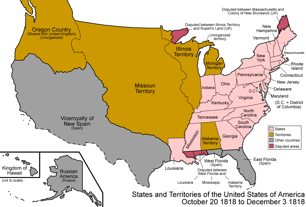
Description: Map of the states and territories of the United States as it was from October 1818 to December 1818. On October 20 1818, the Treaty of 1818 settled the northern border with the holdings of the United Kingdom, and granted joint custody of the Oregon Country to the United Kingdom and United States. On December 3 1818, the southern portion of Illinois Territory was admitted as the state of Illinois, and the rest was joined to Michigan Territory.
Title: United States 1818-10-1818-12
Credit: Own work
Author: Made by User:Golbez.
Permission: Own work, attribution required (Multi-license with GFDL and Creative Commons CC-BY 2.5)
Usage Terms: Creative Commons Attribution 2.5
License: CC BY 2.5
License Link: http://creativecommons.org/licenses/by/2.5
Attribution Required?: Yes
Image usage
The following 8 pages link to this image:
- Outline of North Dakota territorial evolution
- Outline of Oregon territorial evolution
- Outline of Washington territorial evolution
- Outline of Wyoming territorial evolution
- Territorial evolution of Idaho
- Territorial evolution of Montana
- Territorial evolution of Nevada
- Territorial evolution of South Dakota
