
Image: United States 1789-08-1790-04
Size of this preview: 800 × 542 pixels. Other resolutions: 320 × 217 pixels | 1,000 × 677 pixels.
Original image (1,000 × 677 pixels, file size: 45 KB, MIME type: image/png)
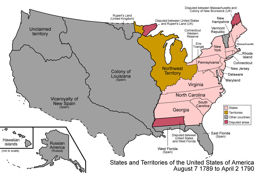
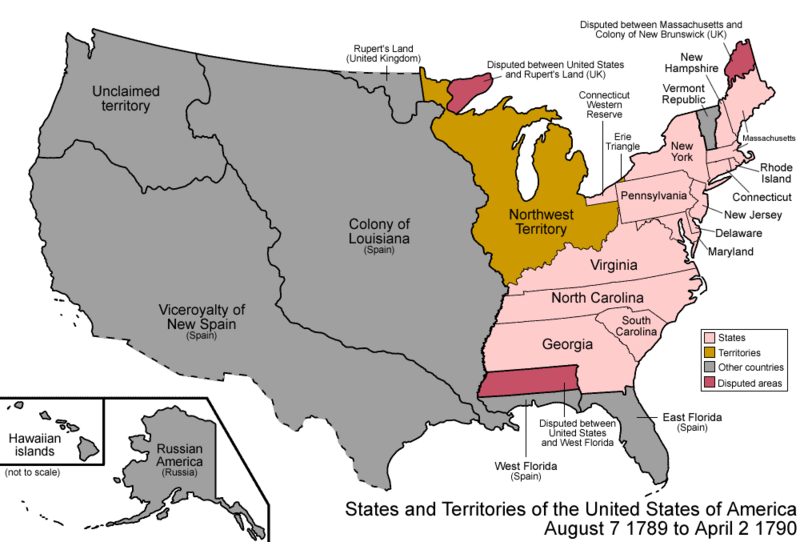
Description: Map of the states and territories of the United States as it was from August 1789 to April 1790. On August 7 1789, the Northwest Territory was organized. On April 2 1790, the Congress accepted North Carolina's cession of its western lands.
Title: United States 1789-08-1790-04
Credit: Own work
Author: Made by User:Golbez.
Permission: Own work, attribution required (Multi-license with GFDL and Creative Commons CC-BY 2.5)
Usage Terms: Creative Commons Attribution 2.5
License: CC BY 2.5
License Link: https://creativecommons.org/licenses/by/2.5
Attribution Required?: Yes
Image usage
The following page links to this image:

All content from Kiddle encyclopedia articles (including the article images and facts) can be freely used under Attribution-ShareAlike license, unless stated otherwise.