
Image: United Kingdom general election 1880

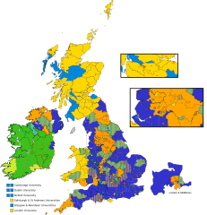
Description: Map of the United Kingdom 1880 general election results. Constituencies varied in the number of Member returned, with the smallest constituencies returning 1 member, and the largest returning 4 members. Hatched colouring is used in constituencies returning members from separate parties. So, a 2:1 hatch indicates that 2 of the 3 members returned came from 1 party, with the remaining member coming from another. The colouring is also used to indicate this. Constituency returned 1 Liberal Constituency returned 2 Liberals Constituency returned 3 Liberals Constituency returned 1 Conservative Constituency returned 2 Conservatives Constituency returned 3 Conservatives Constituency returned 1 Home Ruler Constituency returned 2 Home Rulers Territory not represented in parliament (Isle of Man)
Title: United Kingdom general election 1880
Credit: Own work. Map is based on a variety of sources. Constituency control derived from the English Wikipedia. Constituency boundaries largely based on the map collection at Old Maps Online (which includes the 1832 & 1868 Boundary Commission reports) and the wider Visions of Britain website, by the University of Portsmouth, JISC, and Klokan. These websites provided an invaluable source of information in terms of British constituency demarcations. Irish constituency boundaries in turn were largely based on this work by Irish Political Maps.
Author: MrPenguin20
Permission: This vector image includes elements that have been taken or adapted from this file:
Usage Terms: Creative Commons Attribution-Share Alike 4.0
License: CC BY-SA 4.0
License Link: https://creativecommons.org/licenses/by-sa/4.0
Attribution Required?: Yes
Image usage
The following page links to this image:
