
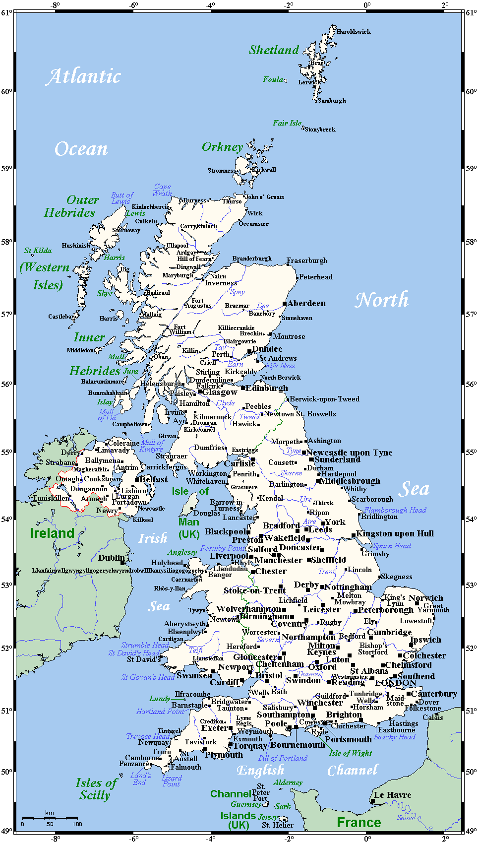
Image: UnitedKingdomCitiesandTownsOMC
Size of this preview: 339 × 600 pixels. Other resolutions: 135 × 240 pixels | 964 × 1,705 pixels.
Original image (964 × 1,705 pixels, file size: 110 KB, MIME type: image/png)
Description: A map showing the United Kingdom's cities (indeed, all municipalities that are officially cities), main towns and selected smaller places.
Title: UnitedKingdomCitiesandTownsOMC
Credit: This map's source is here, with the uploader's modifications, and the GMT homepage says that the tools are released under the GNU General Public License.
Author: Kelisi at English Wikipedia
Usage Terms: Creative Commons Attribution-Share Alike 3.0
License: CC-BY-SA-3.0
License Link: http://creativecommons.org/licenses/by-sa/3.0/
Attribution Required?: Yes
Image usage
The following page links to this image:

All content from Kiddle encyclopedia articles (including the article images and facts) can be freely used under Attribution-ShareAlike license, unless stated otherwise.