
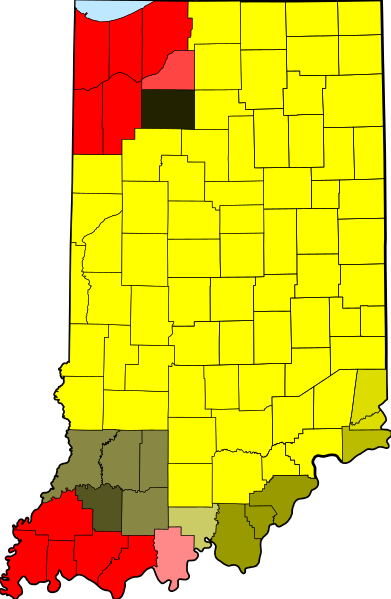
Image: UTC hue4map USA-IN

Size of this PNG preview of this SVG file: 391 × 599 pixels. Other resolution: 156 × 240 pixels.
Original image (SVG file, nominally 2,887 × 4,423 pixels, file size: 61 KB)
Description: tz database zones for the US state of Indiana
Title: UTC hue4map USA-IN
Credit: Map_of_Indiana_highlighting_Adams_County.svg
Author: Map_of_Indiana_highlighting_Adams_County.svg: ???? derivative work: TZ master (talk)
Usage Terms: Public domain
License: Public domain
Attribution Required?: No
Image usage
The following page links to this image:

All content from Kiddle encyclopedia articles (including the article images and facts) can be freely used under Attribution-ShareAlike license, unless stated otherwise.