
Image: US Great Plains Map

Size of this PNG preview of this SVG file: 800 × 495 pixels. Other resolution: 320 × 198 pixels.
Original image (SVG file, nominally 959 × 593 pixels, file size: 87 KB)
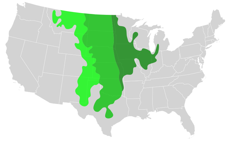
Description: Biogeographical map of the Great Plains.
Showing the different Temperate grasslands ecoregions of the Great Plains in territory claimed by the United States.
Short-grass prairie—(High Plains)
Mid-grass prairie
Tall-grass prairie
Transparency is enabled so that state borders can still be discerned. Data from a display at Brigham Young University's Bean museum.
Author: Blank_US_Map.svg: User:Theshibboleth
Usage Terms: Creative Commons Attribution-Share Alike 3.0
License: CC-BY-SA-3.0
License Link: http://creativecommons.org/licenses/by-sa/3.0/
Attribution Required?: Yes
Image usage
The following page links to this image:

All content from Kiddle encyclopedia articles (including the article images and facts) can be freely used under Attribution-ShareAlike license, unless stated otherwise.