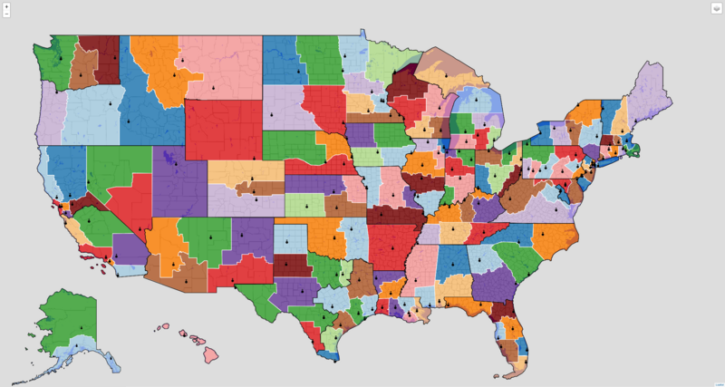
Image: US Catholic Dioceses and Cathedrals

Description: This is a map of all Catholic Latin-Rite dioceses in the United States. I created the map using Python and geojson.io. I used OpenStreetMap and Wikipedia data to revise diocese boundaries and plot cathedral locations. (If this use of OpenStreetMap and Wikipedia data requires that I publish the map under the CC-BY-SA license instead of the CC-BY license, please let me know.) White lines are diocesan boundaries; black lines are provincial boundaries; and globus cruciger symbols are cathedral locations An interactive version of this map can be found here: https://kburchfiel.github.io/us_diocese_mapper/revised_diocese_map.html The project's GitHub page can be found here: https://github.com/kburchfiel/us_diocese_mapper
Title: US Catholic Dioceses and Cathedrals
Credit: Own work
Author: Kenneth Burchfiel
Usage Terms: Creative Commons Attribution 4.0
License: CC BY 4.0
License Link: https://creativecommons.org/licenses/by/4.0
Attribution Required?: Yes
Image usage
The following page links to this image:

