
Image: USGS topographic map, Michigan, Wyandotte quadrangle (278613), 1906, 1-62500 (cropped to Fox and Powder House Islands)
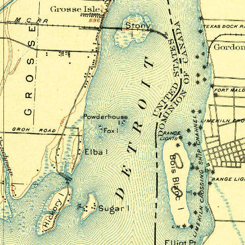
Description: USGS survey map of w:Wyandotte, Michigan, as well as w:Amherstsburg, Canada, and the w:Detroit River. Original map is from 1906, at 1:62500 scale. Image cropped from USGS historical map, available from TopoViewer. https://ngmdb.usgs.gov/topoview/viewer/#14/42.1124/-83.1392. Topography, State of Michigan: Wyandotte Quadrangle. H.M. Wilson, Chas E. Cooke, J.T. McCoy , J.N. Williamson. United States Geological Survey, 1906
Title: USGS topographic map, Michigan, Wyandotte quadrangle (278613), 1906, 1-62500 (cropped to Fox and Powder House Islands)
Credit: https://ngmdb.usgs.gov/topoview/viewer/
Author: USGS
Permission: This image is in the public domain in the United States because it only contains materials that originally came from the United States Geological Survey, an agency of the United States Department of the Interior. For more information, see the official USGS copyright policy.
Usage Terms: Public domain
License: Public domain
Attribution Required?: No
Image usage
The following 2 pages link to this image:

,_1906,_1-62500_(cropped_to_Fox_and_Powder_House_Islands).jpg)