
All content from Kiddle encyclopedia articles (including the article images and facts) can be freely used under Attribution-ShareAlike license, unless stated otherwise.
 |
|
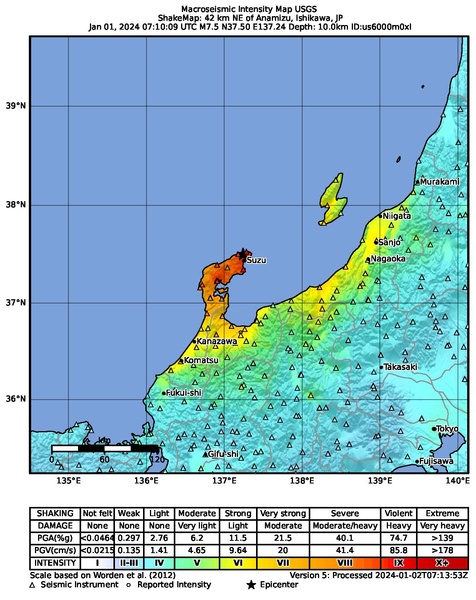
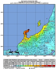
Description: Macroseismic Intensity Map USGS ShakeMap: 42 km NE of Anamizu, Ishikawa, JP
Jan 01, 2024 07:10:09 UTC M7.5 N37.50 E137.24 Depth: 10.0km ID:us6000m0xl
Usage Terms: Public domain
The following 2 pages link to this image: