
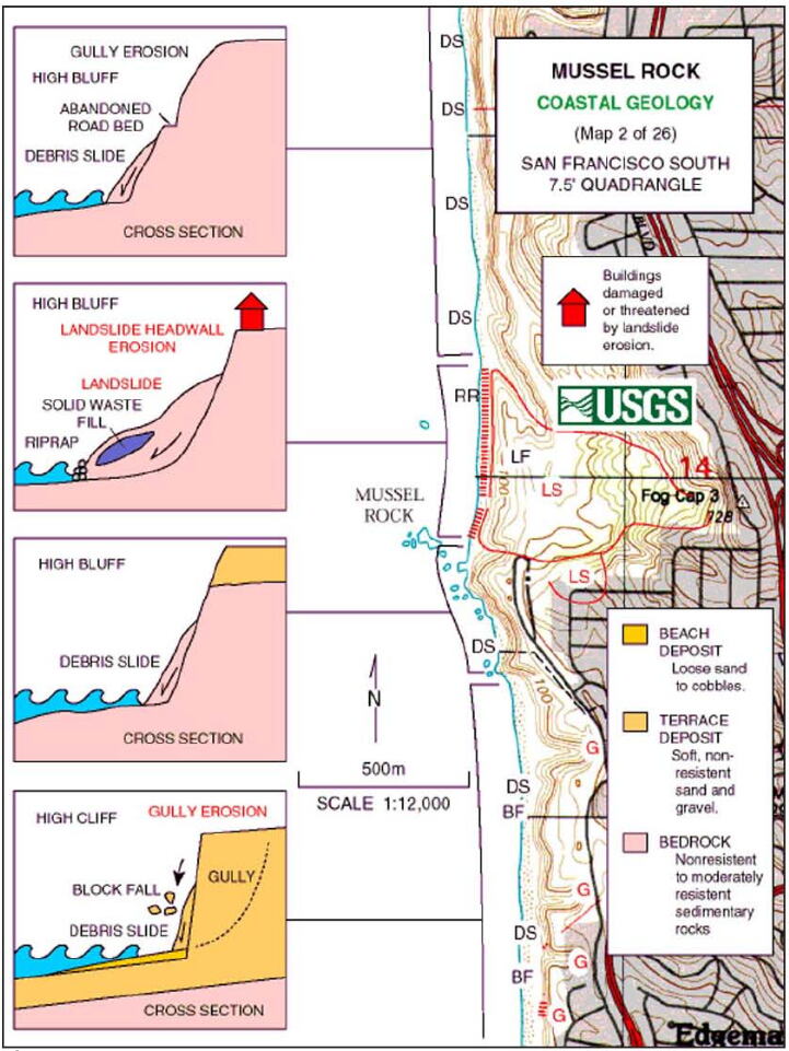
Image: USGS 1982-1983 El Nino San Mateo Coastal Reosion Diagram
Size of this preview: 450 × 600 pixels. Other resolutions: 180 × 240 pixels | 721 × 961 pixels.
Original image (721 × 961 pixels, file size: 130 KB, MIME type: image/jpeg)
Description: A diagram published by the USGS illustrating different types of coastal erosion occuring during 1982-1983 during an El Nino cycle.
Title: USGS 1982-1983 El Nino San Mateo Coastal Reosion Diagram
Credit: USGS survey data via Shawn Heiser's 2010 thesis on Mussel Rock
Author: USGS
Usage Terms: Public domain
License: Public domain
Attribution Required?: No
Image usage
The following page links to this image:

All content from Kiddle encyclopedia articles (including the article images and facts) can be freely used under Attribution-ShareAlike license, unless stated otherwise.