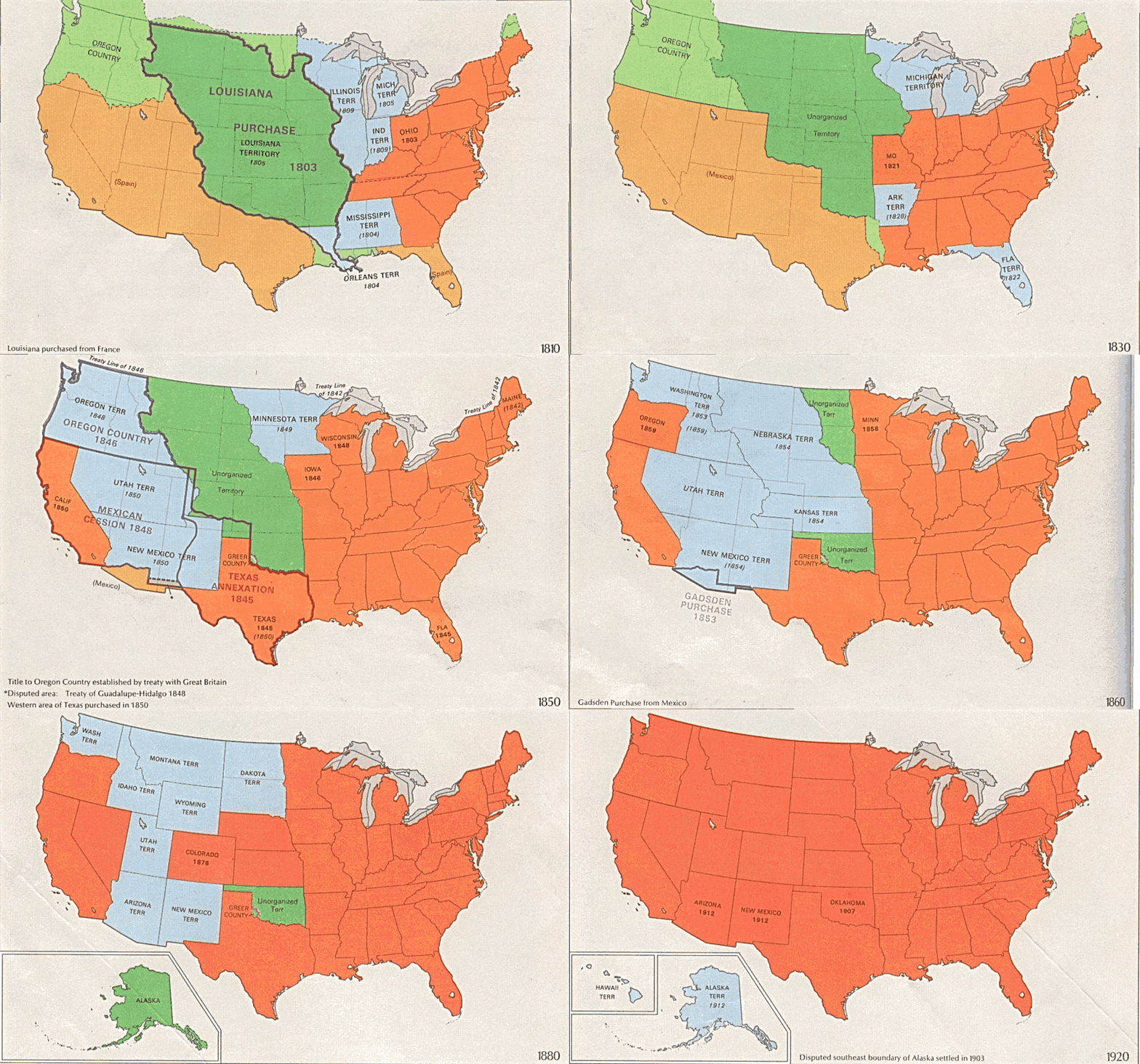
Image: USA territorial growth

Size of this preview: 800 × 498 pixels. Other resolutions: 320 × 199 pixels | 921 × 573 pixels.
Original image (921 × 573 pixels, file size: 2.01 MB, MIME type: image/gif, looped, 10 frames, 50 s)
Description: US territorial growth 1810–1920, based on the PD USGS maps in Category:Territorial growth maps of the United States. See key below for explanation of colors.
Title: USA territorial growth
Credit: United States Geological Survey (USGS) Own work. Images put together in Corel Painter IX.
Author: Original: United States Geological Survey (USGS) Derivative work: Roke~commonswiki
Usage Terms: Public domain
License: Public domain
Attribution Required?: No
Image usage
The following page links to this image:

All content from Kiddle encyclopedia articles (including the article images and facts) can be freely used under Attribution-ShareAlike license, unless stated otherwise.
