
Image: Typhoon Bopha 2012 making landfall
No higher resolution available.
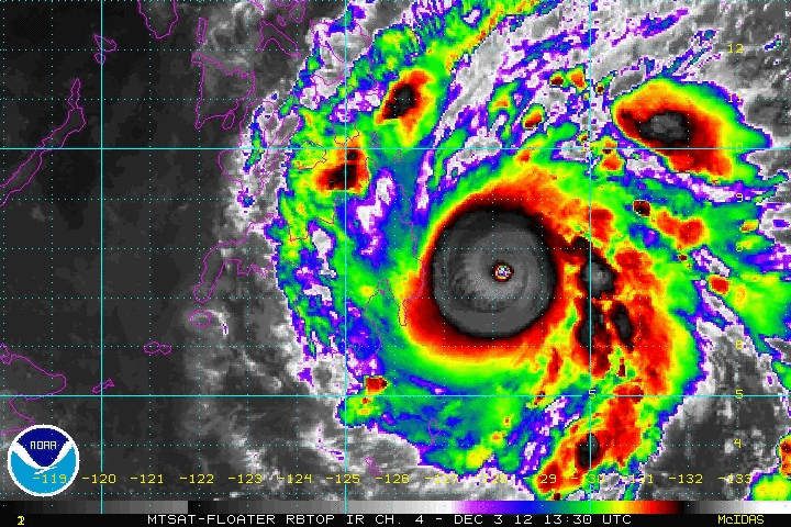
Typhoon_Bopha_2012_making_landfall.gif (720 × 480 pixels, file size: 3.73 MB, MIME type: image/gif, looped, 15 frames, 3.1 s)
Description: Animated enhanced infrared satellite loop of Typhoon Bopha (also known as Typhoon Pablo in the Philippines) from 1330 UTC on December 3 to 0330 UTC December 4, 2012. These images show the storm at peak intensity and making landfall in the southern Philippine island of Mindanao.
Title: Typhoon Bopha 2012 making landfall
Credit: http://www.ssd.noaa.gov/PS/TROP/floaters/
Author: National Oceanic and Atmospheric Administration Satellite Services Division
Usage Terms: Public domain
License: Public domain
Attribution Required?: No
Image usage
The following page links to this image:

All content from Kiddle encyclopedia articles (including the article images and facts) can be freely used under Attribution-ShareAlike license, unless stated otherwise.