
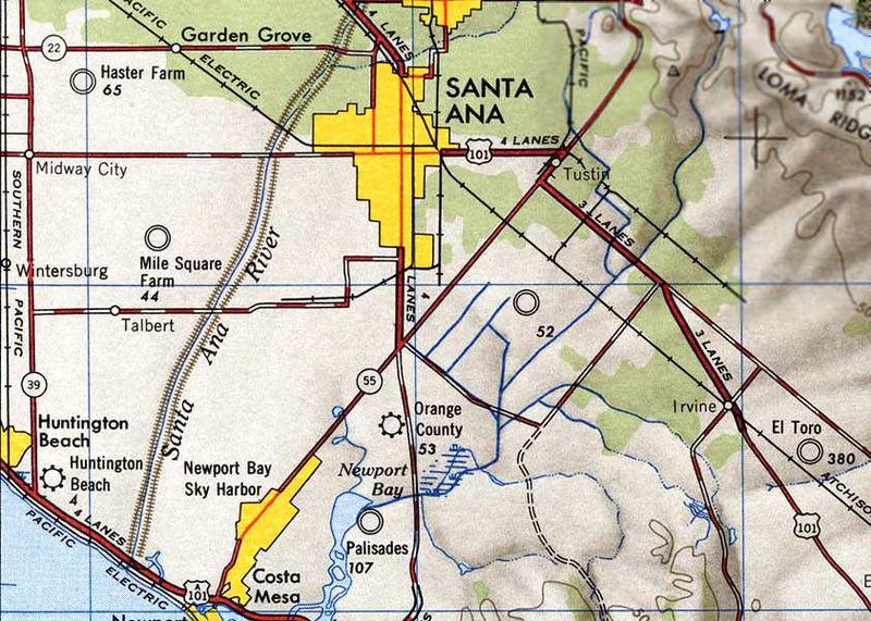
Image: Tustin CA 47topo

Size of this preview: 800 × 571 pixels. Other resolutions: 320 × 228 pixels | 842 × 601 pixels.
Original image (842 × 601 pixels, file size: 98 KB, MIME type: image/jpeg)
Description: USGS Tustin California topo map from 1947
Title: Tustin CA 47topo
Credit: https://members.tripod.com/airfields_freeman/CA/Airfields_CA_OrangeCo_C.htm#mile
Author: USGS
Usage Terms: Public domain
License: PD
Attribution Required?: No
Image usage
The following page links to this image:

All content from Kiddle encyclopedia articles (including the article images and facts) can be freely used under Attribution-ShareAlike license, unless stated otherwise.