Image: Tupelo Battlefield Mississippi

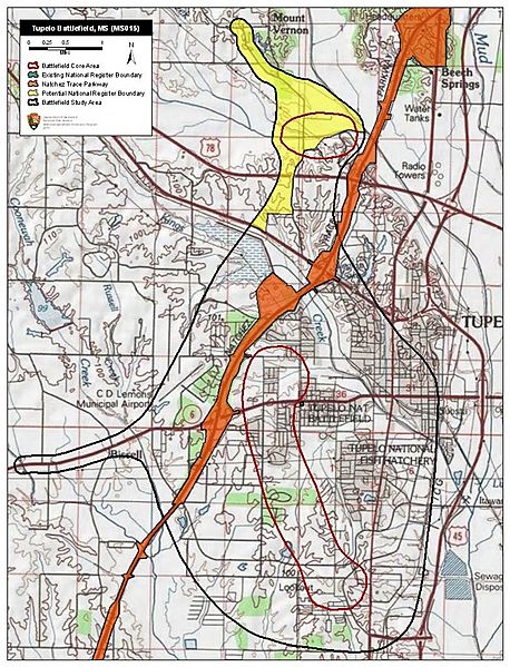
Description: Map of battlefield core and study areas. The ABPP enlarged the Study Area boundary to include locations of fighting to the north and troop movements made in preparation for engagement to the north, west, and south. The revised boundary also includes the western approach route used by Confederates responding to news of Federal activity in Tupelo, as well as the route taken by withdrawing Federal forces, which connects the prime Core Area in the south with the secondary, northern Core Area. The ABPP redrew the southern Core Area to include only locations of fighting confirmed by primary source documentation, and added a new Core Area in the north where fighting occurred at Old Town Creek.
Title: Tupelo Battlefield Mississippi
Credit: National Park Service
Author: American Battlefield Protection Program
Usage Terms: Public domain
License: Public domain
Attribution Required?: No
Image usage
The following page links to this image:

