
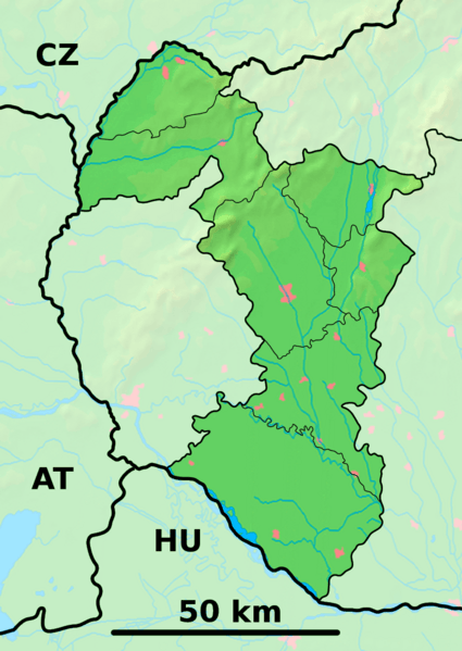
Image: Trnava Region - physical map

Size of this preview: 425 × 599 pixels. Other resolutions: 170 × 240 pixels | 880 × 1,240 pixels.
Original image (880 × 1,240 pixels, file size: 684 KB, MIME type: image/png)
Description: Background map of the Trnava Region, Slovakia, ready for the Geobox template, calibrated at en:Template:Geobox locator Trnava Region Outline map of the Trnava Region, Slovakia, ready for the Geobox template, calibrated at en:Template:Geobox locator Trnava Region
Title: Trnava Region - physical map
Credit: Trnava_Region_-_background_map.png Trnava_Region_-_outline_map.svg
Author: Trnava_Region_-_background_map.png: Caroig Trnava_Region_-_outline_map.svg: Caroig derivative work: Adehertogh (talk)
Usage Terms: Creative Commons Attribution-Share Alike 3.0
License: CC BY-SA 3.0
License Link: https://creativecommons.org/licenses/by-sa/3.0
Attribution Required?: Yes
Image usage
The following page links to this image:

All content from Kiddle encyclopedia articles (including the article images and facts) can be freely used under Attribution-ShareAlike license, unless stated otherwise.