
Image: Trench Map 62b.NW (Bellicourt) (detail)
Size of this preview: 798 × 599 pixels. Other resolutions: 320 × 240 pixels | 1,936 × 1,454 pixels.
Original image (1,936 × 1,454 pixels, file size: 997 KB, MIME type: image/jpeg)
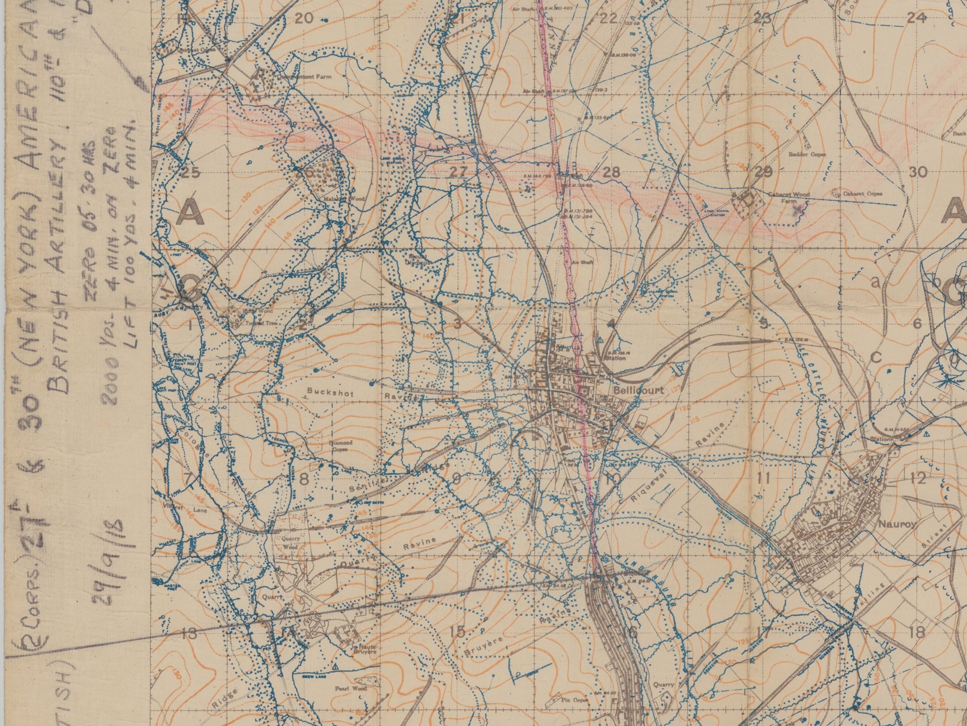
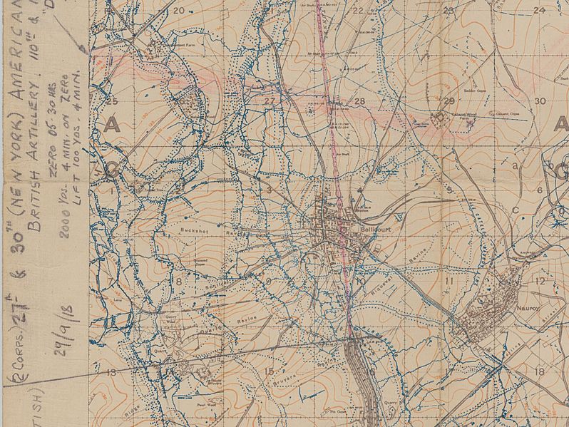
Description: Detail from a 1;20,000 scale trench map 62.b NW (Bellicourt), showing the complexity of the Hindenburg Line defences, including the outpost line at left, the main line and the Le Catelet-Nauroy Line. The map carries annotations made by an officer of the Royal Field Artillery supporting U.S. 30th Division, in the 29th September attack.
Title: Trench Map 62b.NW (Bellicourt) (detail)
Credit: McMaster University Library, Ontario website
Author: War Office (U.K.)
Usage Terms: Creative Commons Attribution 2.5
License: CC BY 2.5
License Link: https://creativecommons.org/licenses/by/2.5
Attribution Required?: Yes
Image usage
The following page links to this image:

All content from Kiddle encyclopedia articles (including the article images and facts) can be freely used under Attribution-ShareAlike license, unless stated otherwise.
_(detail).jpg)