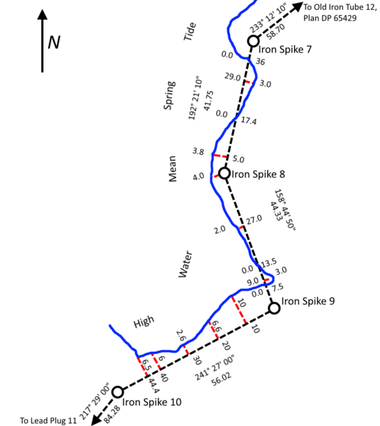
Image: Traversing and Offsetting DP 79152

Description: A simplified tracing of part of North Auckland Deposited Plan 79152 showing survey reference markers, traverse lines and offset measurements used to determine the location of a shoreline being used as a legal boundary line. This work is based on/includes LINZ’s data which are licensed by Land Information New Zealand (LINZ) for re-use under the Creative Commons Attribution 3.0 New Zealand licence.
Title: Traversing and Offsetting DP 79152
Credit: This work is based on/includes LINZ’s data which are licensed by Land Information New Zealand (LINZ) for re-use under the Creative Commons Attribution 3.0 New Zealand licence.
Author: Land Information New Zealand, Derivative work by TBP25
Usage Terms: Creative Commons Attribution 3.0
License: CC BY 3.0
License Link: http://creativecommons.org/licenses/by/3.0
Attribution Required?: Yes
Image usage
The following page links to this image:

