
Image: Transactions of the Royal Society of New Zealand (1920) (14578410949)
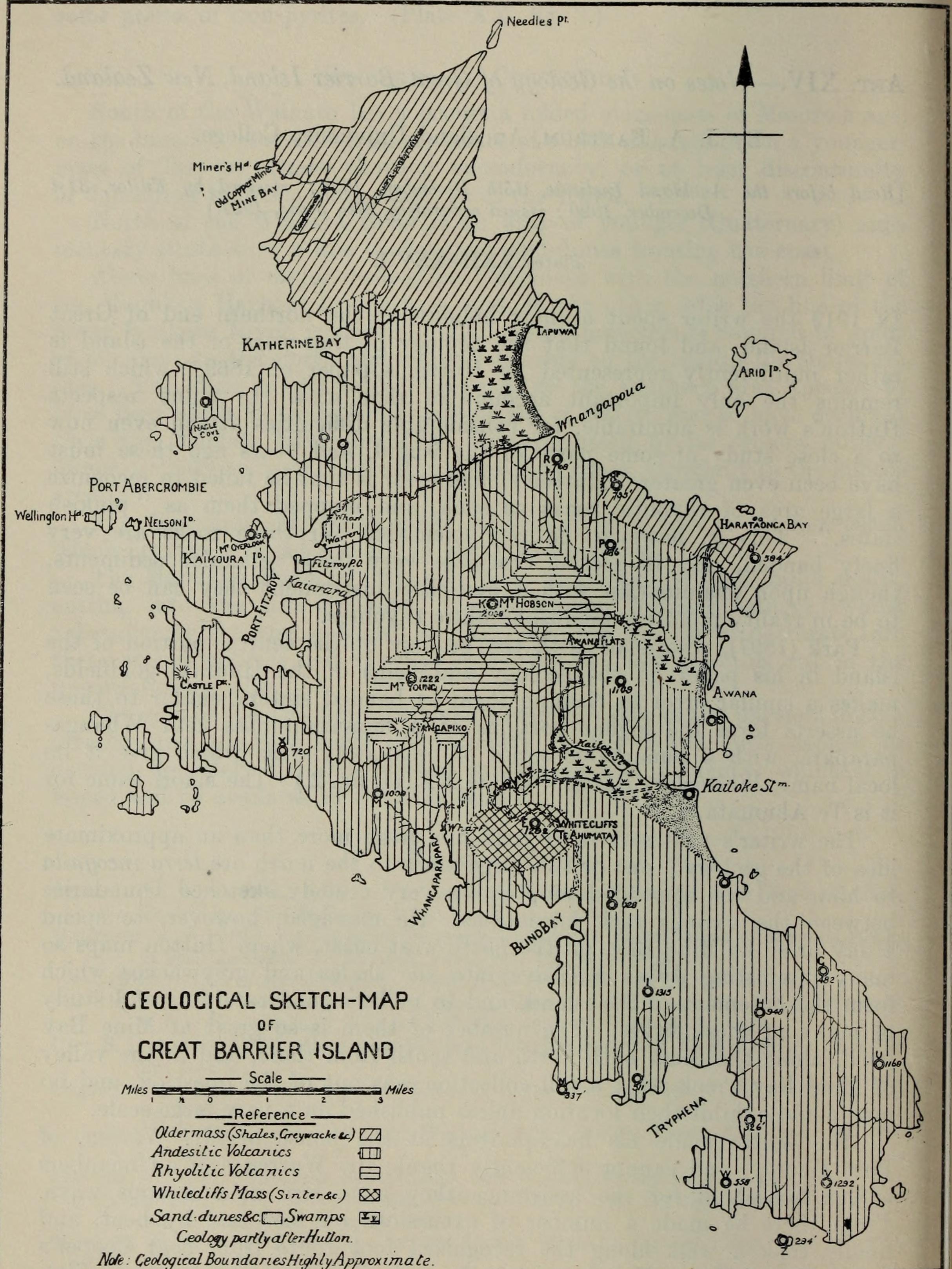
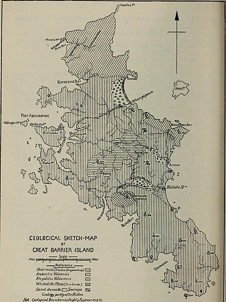
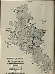
Description: Identifier: transactionsofro19200roya (find matches) Title: Transactions of the Royal Society of New Zealand Year: 1920 (1920s) Authors: Royal Society of New Zealand Subjects: Science Publisher: Wellington, N.Z. : The Society Contributing Library: Brigham Young University Hawaii, Joseph F. Smith Library Digitizing Sponsor: Consortium of Church Libraries and Archives View Book Page: Book Viewer About This Book: Catalog Entry View All Images: All Images From Book Click here to view book online to see this illustration in context in a browseable online version of this book. Text Appearing Before Image: ne Bay, on the north-west coast, where Hutton maps somany interesting dykes intrusive into the shales and greywackes whichform the basement of the island, and to make a moderately careful studyof many of these dykes. The number of them is so great at Mine Bayitself, along the coast both north and south from there, and in the valleyof Mine Bay Creek, that a full collection was out of the question, and nomap could exhibit their location unless published on a very large scale. The writer made his headquarters at the house of Mr. Warren, ofPort Fitzroy; and cannot sufficiently thank Mr. Warren and all membersof his household for the assistance they gave him in numerous ways.From there he made a number of excursions on foot and by boat, andfinally took a walk along the recognized foot route from near Coopersto the top of Mount Hobson, thence by a devious traverse to Awana Flat, * Full reference is appended in a list of literature cited to be found at the end ofthis paper. 116 Transactions. Text Appearing After Image: CEOLOCICAL SKETCH-MAPor CREAT BARRIER ISLAND Scale .Reference (XdermaSS(Shales.CrcymacAttt) U2 AndesiUc Volcasitcs flTTl Rhyoliltc Volcamcs R WhrfediffsMass^rrier&c)ScLnddunes&ci \Swamps ;XBGeology partly afkrHutton.Note: GeologicalBoundariesHighlyApproximate Bartrum.—Geology of Great Barrier Island. 117 from which place he visited Oroville, in the Kaitoke Valley, and thenreturned by the road and tracks along the east coast from Kaitoke Creekto Harataonga Bay, whence he took the bush track, crossing the highercountry some distance from the coast, to Whangapoua. In spite of the cursory nature of the writers examination of a largeportion of the area mapped, it appeared to him desirable to make suchprovisional alterations and additions to Huttons account of its geologyas are now possible, instead of waiting perhaps a long time until anopportunity presented itself for making a more thorough geological survey. Scheme of Paper. The aim of this paper on the geology of Great Barrier Note About Images Please note that these images are extracted from scanned page images that may have been digitally enhanced for readability - coloration and appearance of these illustrations may not perfectly resemble the original work.
Title: Transactions of the Royal Society of New Zealand (1920) (14578410949)
Credit: https://www.flickr.com/photos/internetarchivebookimages/14578410949/ Source book page: https://archive.org/stream/transactionsofro19200roya/transactionsofro19200roya#page/n185/mode/1up
Author: Royal Society of New Zealand
Permission: At the time of upload, the image license was automatically confirmed using the Flickr API. For more information see Flickr API detail.
Usage Terms: No known copyright restrictions
License: No restrictions
License Link: https://www.flickr.com/commons/usage/
Attribution Required?: No
Image usage
The following page links to this image:

_(14578410949).jpg)