
Image: Trafalgar 1200hr

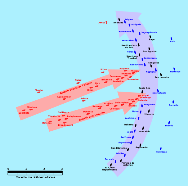
Description: This map of the Battle of Trafalgar shows the approximate position of the two fleets at 1200 hours during the battle as the Royal Sovereign was breaking into the Franco-Spanish line. North is to the top, and Cape Trafalgar is 10 miles to the northeast.
Title: Trafalgar 1200hr
Credit: own work made with Inkscape from Image:Trafalgar 1200hr.gif : This drawing is based on an illustration in issue number 84 of the Strategy & Tactics magazine The map was made by RJHall using the Campaign Cartographer drawing program, and the image was reduced in size 50% in Paint Shop Pro. Ship icons are not to scale.
Author: Pinpin
Usage Terms: Creative Commons Attribution-Share Alike 3.0
License: CC BY-SA 3.0
License Link: https://creativecommons.org/licenses/by-sa/3.0
Attribution Required?: Yes
Image usage
The following 2 pages link to this image:
