
Image: TradeWinds Hawaii QuikSCAT aug99
Size of this preview: 485 × 599 pixels. Other resolutions: 194 × 240 pixels | 540 × 667 pixels.
Original image (540 × 667 pixels, file size: 56 KB, MIME type: image/png)
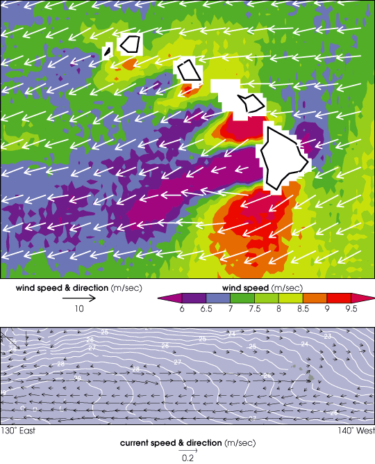
Description: The top image is a w:QuikSCAT satellite image of the effect of the Hawaiian Islands on the trade winds. Between islands the winds increase, while in the wake of the islands the winds are remarkably weaker. The bottom image (from the w:TRMM) shows the ocean current formed by the islands' wake. Arrows indicate current direction and speed (derived from a general circulation model), while white contours show ocean temperatures.
Title: TradeWinds Hawaii QuikSCAT aug99
Credit: http://visibleearth.nasa.gov/view_rec.php?vev1id=8189
Author: NASA
Permission: Public domain
Usage Terms: Public domain
License: Public domain
Attribution Required?: No
Image usage
The following page links to this image:

All content from Kiddle encyclopedia articles (including the article images and facts) can be freely used under Attribution-ShareAlike license, unless stated otherwise.