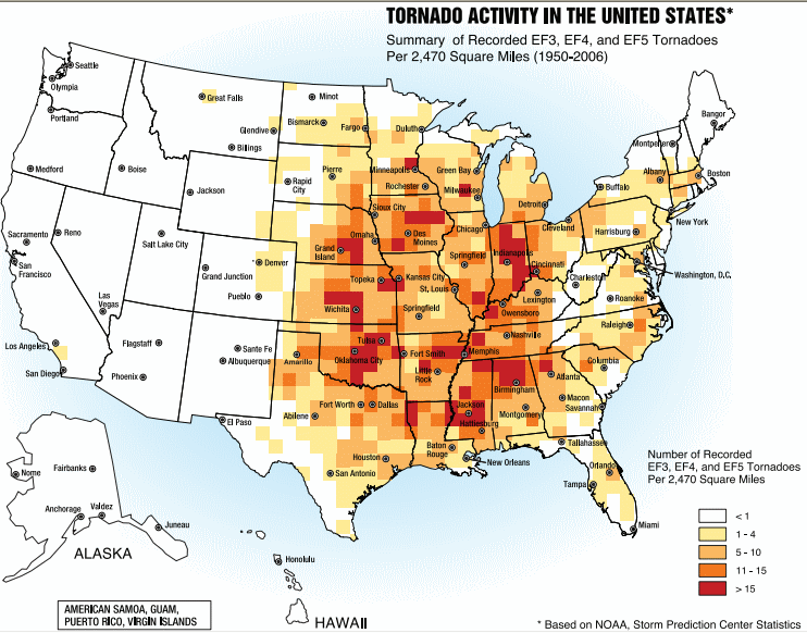
Image: Tornado Alley
Tornado_Alley.gif (742 × 582 pixels, file size: 97 KB, MIME type: image/gif)
Description: A map of the frequency of F3 and greater intensity tornadoes by area. The darker colors highlight the areas typically known as a Tornado Alley.
Title: Tornado Alley
Credit: Image from Federal Emergency Management Agency, a United States government agency, booklet FEMA 320 Third Edition, Section 1, Figure 1.1, page 3, titled Taking Shelter from the Storm: Building a Safe Room Inside your House
Author: FEMA personnel
Usage Terms: Public domain
License: Public domain
Attribution Required?: No
Image usage
The following page links to this image:

All content from Kiddle encyclopedia articles (including the article images and facts) can be freely used under Attribution-ShareAlike license, unless stated otherwise.

