Image: Tomotley-debrahm-map
Tomotley-debrahm-map.jpg (599 × 452 pixels, file size: 79 KB, MIME type: image/jpeg)
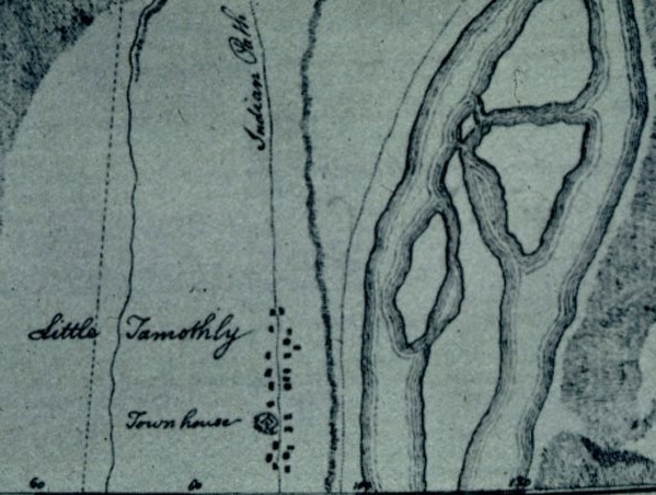
Description: Map showing the Cherokee village of Tomotley, which was once located along the Little Tennessee River in what is now Monroe County, Tennessee, United States. The village's townhouse and a road ("Indian Path") are labeled.
Title: Tomotley-debrahm-map
Credit: Volunteer Voices (University of Tennessee digital collections)
Author: William G. De Brahm (d. 1799)
Usage Terms: Public domain
License: Public domain
Attribution Required?: No
Image usage
The following page links to this image:

All content from Kiddle encyclopedia articles (including the article images and facts) can be freely used under Attribution-ShareAlike license, unless stated otherwise.

