
Image: TombouctouPachalik 4
Size of this preview: 605 × 599 pixels. Other resolutions: 242 × 240 pixels | 742 × 735 pixels.
Original image (742 × 735 pixels, file size: 12 KB, MIME type: image/png)
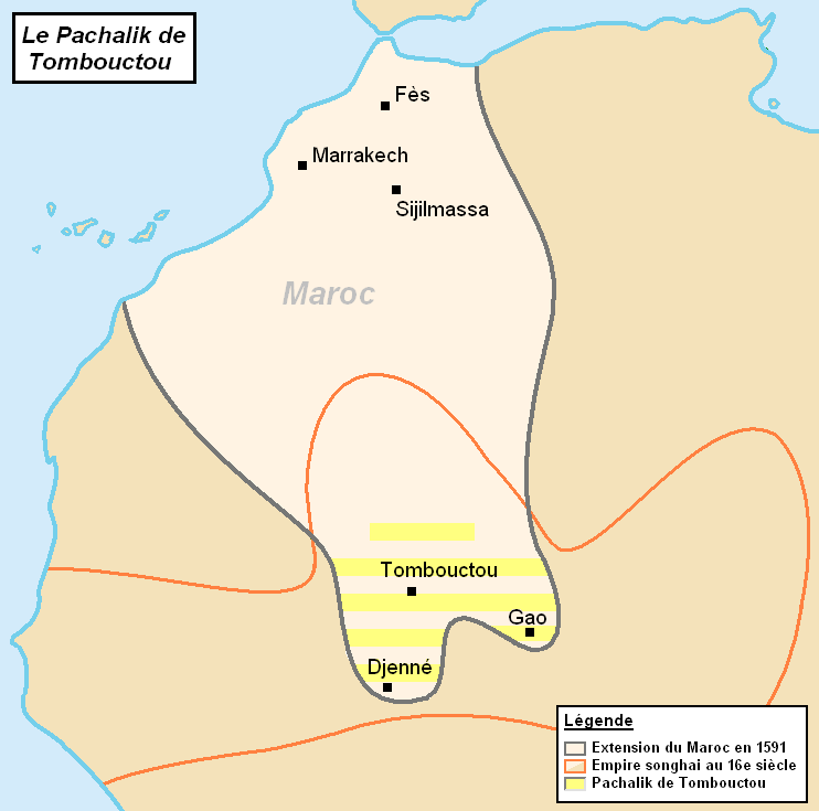
Description: Carte localisant le Pachalik de Tombouctou au sein du Maroc. Sources: "L’Empire songhaï au XVIe siècle", par P. Boiley sur www.ladocumentationfrancaise.fr [1] "Trade and empire in Africa, 1500-1800", Times Books 2007 sur qed.princeton.edu [2]
Title: TombouctouPachalik 4
Credit: Own work
Author: Omar-Toons
Usage Terms: Creative Commons Attribution-Share Alike 3.0
License: CC BY-SA 3.0
License Link: https://creativecommons.org/licenses/by-sa/3.0
Attribution Required?: Yes
Image usage
The following page links to this image:

All content from Kiddle encyclopedia articles (including the article images and facts) can be freely used under Attribution-ShareAlike license, unless stated otherwise.