Image: Ticsani
Ticsani.jpg (640 × 453 pixels, file size: 76 KB, MIME type: image/jpeg)
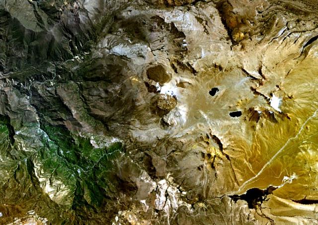
Description: The Ticsani dacitic lava dome complex (center) lies ESE of Arequipa SE of the Río Putina (upper left) about 50 km east of the main volcanic front of the Peruvian Andes. A fresh-looking lava field forms the dark-colored area north of the main edifice in this NASA Landsat image (with north to the top). No historical eruptions are known from Ticsani, but fumarolic activity continues.
Title: Ticsani
Credit: http://www.volcano.si.edu/world/volcano.cfm?vnum=1504-031&volpage=photos&photo=114099
Author: NASA Landsat7 image (worldwind.arc.nasa.gov)
Usage Terms: Public domain
License: Public domain
Attribution Required?: No
Image usage
The following page links to this image:

All content from Kiddle encyclopedia articles (including the article images and facts) can be freely used under Attribution-ShareAlike license, unless stated otherwise.

