
Image: The Stanegate above Vindolanda - geograph.org.uk - 785569
No higher resolution available.
The_Stanegate_above_Vindolanda_-_geograph.org.uk_-_785569.jpg (640 × 480 pixels, file size: 57 KB, MIME type: image/jpeg)
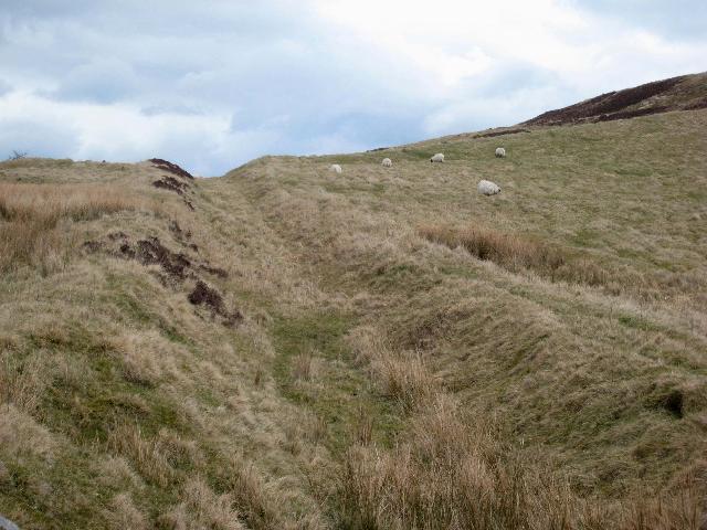
Description: The Stanegate above Vindolanda The Stanegate or Stangate was a Roman Road which carried civilian traffic and trade between Corbridge and Carlisle, and ran a short way to the south of Hadrian's Wall. The name Stanegate is medieval in origin. Just east of this point, the line of the Stanegate is followed by a modern tarmac road. http://en.wikipedia.org/wik/Stanegate
Title: The Stanegate above Vindolanda - geograph.org.uk - 785569
Credit: From geograph.org.uk
Author: Oliver Dixon
Usage Terms: Creative Commons Attribution-Share Alike 2.0
License: CC BY-SA 2.0
License Link: https://creativecommons.org/licenses/by-sa/2.0
Attribution Required?: Yes
Image usage
The following page links to this image:

All content from Kiddle encyclopedia articles (including the article images and facts) can be freely used under Attribution-ShareAlike license, unless stated otherwise.