
Image: The Dingle Way - geograph.org.uk - 921111
No higher resolution available.
The_Dingle_Way_-_geograph.org.uk_-_921111.jpg (640 × 344 pixels, file size: 132 KB, MIME type: image/jpeg)
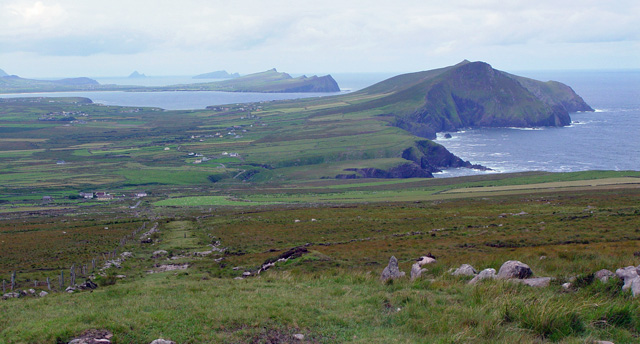
Description: The Dingle Way The Dingle Way is the broad path that can be seen running downhill directly in front of the photographer, and towards Smerwick Harbour. On the right is Ballydavid Head (4 km distant).
Title: The Dingle Way - geograph.org.uk - 921111
Credit: From geograph.org.uk
Author: Peter Church
Usage Terms: Creative Commons Attribution-Share Alike 2.0
License: CC BY-SA 2.0
License Link: https://creativecommons.org/licenses/by-sa/2.0
Attribution Required?: Yes
Image usage
The following 2 pages link to this image:

All content from Kiddle encyclopedia articles (including the article images and facts) can be freely used under Attribution-ShareAlike license, unless stated otherwise.