
Image: The Babylonian map of the world, from Sippar, Mesopotamia.
Size of this preview: 800 × 531 pixels. Other resolutions: 320 × 213 pixels | 4,288 × 2,848 pixels.
Original image (4,288 × 2,848 pixels, file size: 9.66 MB, MIME type: image/jpeg)
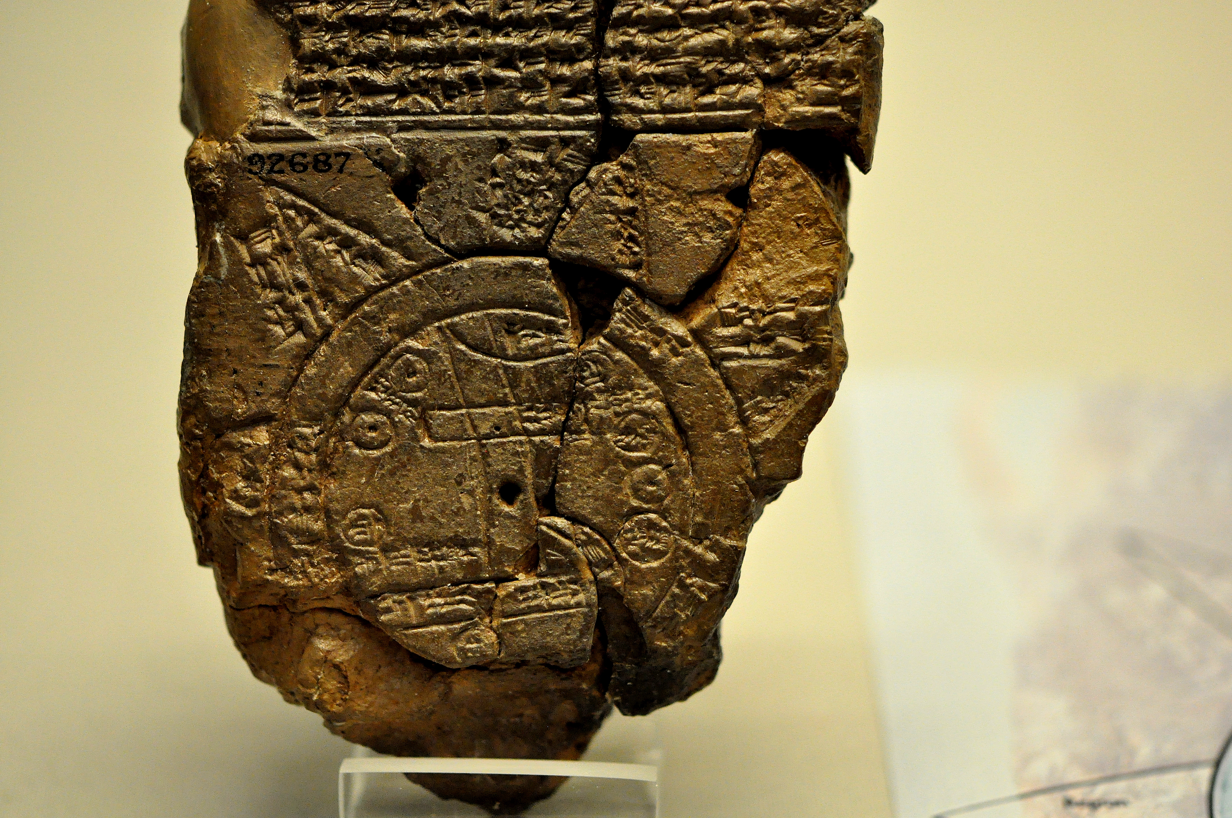
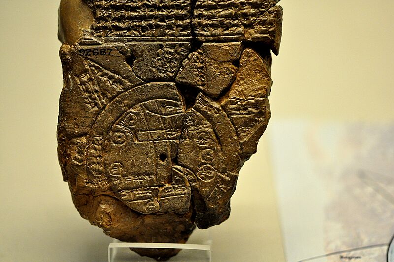
Description: A close-up view of the Babylonian map of the World. This partially broken clay tablet contains both cuneiform inscriptions and a unique map of the Mesopotamian world. Probably from Sippar, Mesopotamia, Iraq. 700-500 BCE. The British Museum, London.
Title: The Babylonian map of the world, from Sippar, Mesopotamia.
Credit: Own work
Author: Osama Shukir Muhammed Amin FRCP(Glasg)
Usage Terms: Creative Commons Attribution-Share Alike 4.0
License: CC BY-SA 4.0
License Link: https://creativecommons.org/licenses/by-sa/4.0
Attribution Required?: Yes
Image usage
The following page links to this image:

All content from Kiddle encyclopedia articles (including the article images and facts) can be freely used under Attribution-ShareAlike license, unless stated otherwise.