
Image: Teuchitlan tradition map

Size of this PNG preview of this SVG file: 482 × 441 pixels. Other resolution: 262 × 240 pixels.
Original image (SVG file, nominally 482 × 441 pixels, file size: 259 KB)
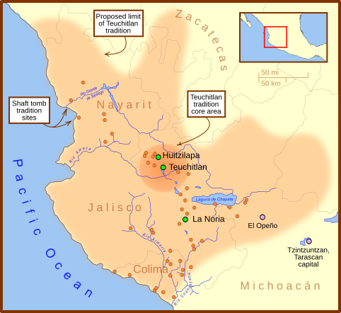
Description: Map of western Mexico, highlighting the core area of the Teuchitlan tradition. Green circles show sites associated with the Teuchitlan tradition. Orange circles show sites associated with the w:en:Western Mexico shaft tomb tradition.
Title: Teuchitlan tradition map
Credit: Own work
Author: Madman2001
Usage Terms: Creative Commons Attribution-Share Alike 3.0
License: CC-BY-SA-3.0
License Link: http://creativecommons.org/licenses/by-sa/3.0/
Attribution Required?: Yes
Image usage
The following page links to this image:

All content from Kiddle encyclopedia articles (including the article images and facts) can be freely used under Attribution-ShareAlike license, unless stated otherwise.