
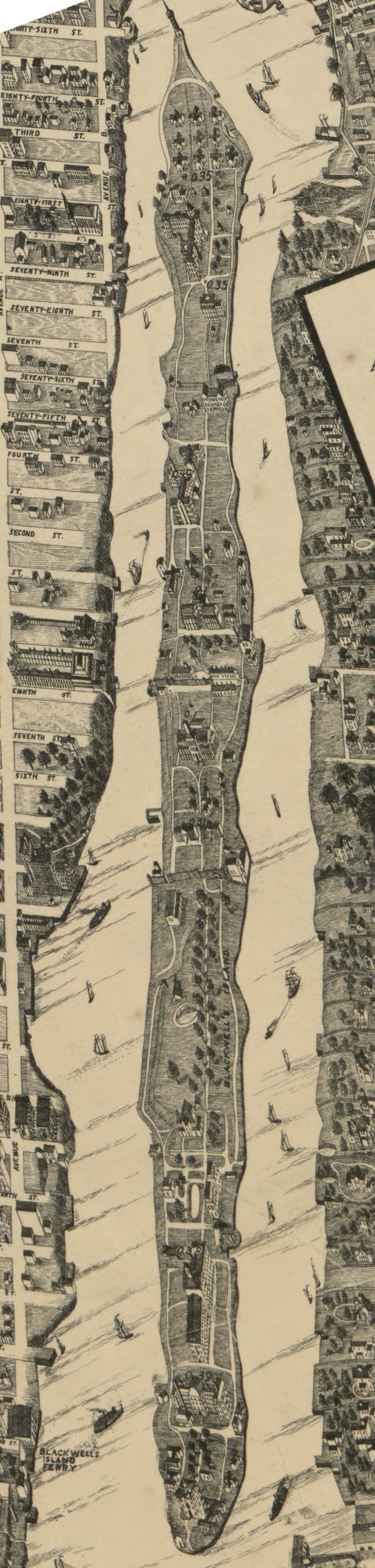
Image: Taylor Map - Roosevelt Island
Size of this preview: 143 × 598 pixels. Other resolutions: 57 × 240 pixels | 831 × 3,474 pixels.
Original image (831 × 3,474 pixels, file size: 586 KB, MIME type: image/jpeg)
Description: Detail from the Taylor Map of New York showing Roosevelt island.
Title: Taylor Map - Roosevelt Island
Credit: http://hdl.loc.gov/loc.gmd/g3804n.pm005990
Author: Will L Taylor
Usage Terms: Public domain
License: Public domain
Attribution Required?: No
Image usage
The following page links to this image:

All content from Kiddle encyclopedia articles (including the article images and facts) can be freely used under Attribution-ShareAlike license, unless stated otherwise.