
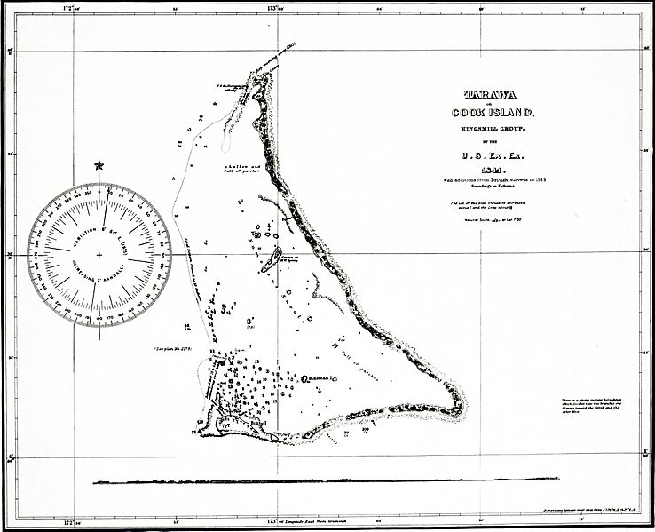
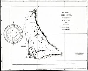
Image: Tarawa 1873 map

Size of this preview: 738 × 599 pixels. Other resolutions: 296 × 240 pixels | 4,277 × 3,473 pixels.
Original image (4,277 × 3,473 pixels, file size: 5.41 MB, MIME type: image/jpeg)
Description: map of Tarawa atoll, Gilbert Islands, Kiribati
Title: Tarawa 1873 map
Credit: This file was derived from: Abaiang-Tarawa 1873 map nla.obj-233983677-1.jpg: http://nla.gov.au/nla.obj-233983677/view
Author: United States. Hydrographic Office
Usage Terms: Public domain
License: Public domain
Attribution Required?: No
Image usage
The following page links to this image:

All content from Kiddle encyclopedia articles (including the article images and facts) can be freely used under Attribution-ShareAlike license, unless stated otherwise.