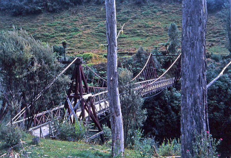
Image: Tangarakau Bridge, New Zealand, 1968

Description: This is one of many similar bridges built in the early 1920s to open up hill country valleys where land had been allocated to returning WW1 servicemen. By the 1960s the difficulties of farming this land was leading to farm abandonments and planned bush regeneration to control erosion. This bridge was maintained to give access to a power line service track. Today - in 2006 - one farm remains up here, with much of the land now held as a forest park. Tangarakau township itself is a ghost town that was originally built to support the construction of the Taumaranui to Stratford railway. The whole story of these districts is redolent of the era when New Zealand thought that land development was unlimited and that you could put any Kiwi joker on to any land and they would find a way of making it productive. When I used to go up here and stay on a farm regularly most of the locals still believed this, but most of them, one by one, were eventually forced off by overwhelmingly negative economics.
Title: Tangarakau Bridge, New Zealand, 1968
Credit: Tangarakau Bridge, Taranaki, New Zealand, 1968
Author: Phillip Capper from Wellington, New Zealand
Usage Terms: Creative Commons Attribution 2.0
License: CC BY 2.0
License Link: https://creativecommons.org/licenses/by/2.0
Attribution Required?: Yes
Image usage
The following page links to this image:

