
Image: TanDEM-X image of Salar de Uyuni
Size of this preview: 800 × 513 pixels. Other resolutions: 320 × 205 pixels | 1,874 × 1,202 pixels.
Original image (1,874 × 1,202 pixels, file size: 1.47 MB, MIME type: image/jpeg)
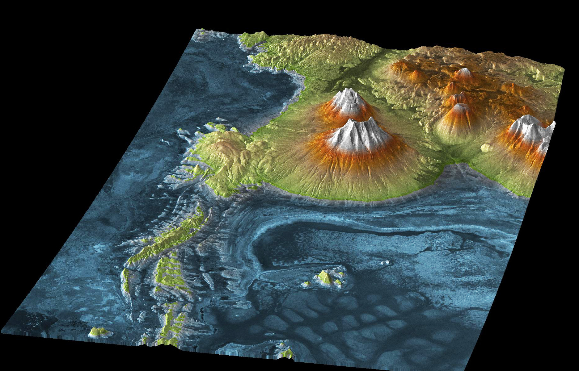
Description: This TanDEM-X image shows Salar de Uyuni, the largest salt flats in the world covering 10,000 square kilometres, located next to the volcanic region of the Atacama Desert. The blue to dark blue areas show the lowest lying parts of the salt flats.
Title: TanDEM-X image of Salar de Uyuni
Credit: http://www.dlr.de/dlr/en/desktopdefault.aspx/tabid-10422/
Author: DLR
Usage Terms: Creative Commons Attribution 3.0
License: CC BY 3.0
License Link: https://creativecommons.org/licenses/by/3.0
Attribution Required?: Yes
Image usage
The following page links to this image:

All content from Kiddle encyclopedia articles (including the article images and facts) can be freely used under Attribution-ShareAlike license, unless stated otherwise.