
Image: Table Mountain Eastern Slopes - Natural Areas - Cape Town
No higher resolution available.
Table_Mountain_Eastern_Slopes_-_Natural_Areas_-_Cape_Town.png (528 × 535 pixels, file size: 544 KB, MIME type: image/png)
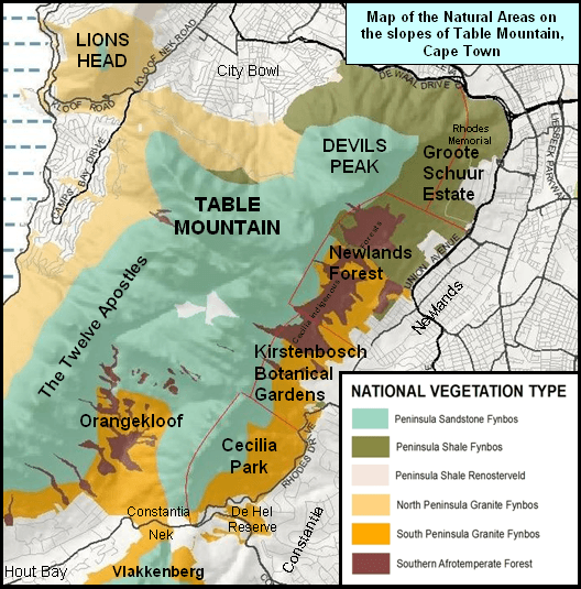
Description: Map of Table Mountain showing the conservation areas and forests of the Eastern Slopes. eg Newlands Forest, Cecilia Park, Kirstenbosch. Map created with info from common knowledge and free public resources.
Title: Table Mountain Eastern Slopes - Natural Areas - Cape Town
Credit: Own work
Author: Abu Shawka
Usage Terms: Creative Commons Attribution-Share Alike 3.0
License: CC BY-SA 3.0
License Link: http://creativecommons.org/licenses/by-sa/3.0
Attribution Required?: Yes
Image usage
The following page links to this image:

All content from Kiddle encyclopedia articles (including the article images and facts) can be freely used under Attribution-ShareAlike license, unless stated otherwise.