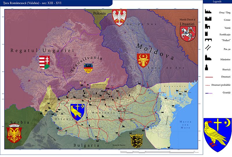
Image: TR XIII - XVI copy

Size of this preview: 800 × 541 pixels. Other resolutions: 320 × 216 pixels | 7,000 × 4,732 pixels.
Original image (7,000 × 4,732 pixels, file size: 18.24 MB, MIME type: image/jpeg)
Description: Historical map of Wallachia. It does not depict a specific moment (year, date) but rather a period. Territorial conquests and disputes made significant changes in the political landscape; cities didn't evolved simultaneous, edifices weren't erected simultaneous... Anyway, the map comprises a bigger, theoretical depiction of Wallachia, rather than a past reality.
Title: TR XIII - XVI copy
Credit: It's my own work based on a flood map from: http://www.nato.inmh.ro/index.php
Author: Seneslav
Permission: www.patzinakia.com
Usage Terms: Creative Commons Attribution 3.0
License: CC BY 3.0
License Link: https://creativecommons.org/licenses/by/3.0
Attribution Required?: Yes
Image usage
The following page links to this image:

All content from Kiddle encyclopedia articles (including the article images and facts) can be freely used under Attribution-ShareAlike license, unless stated otherwise.
