
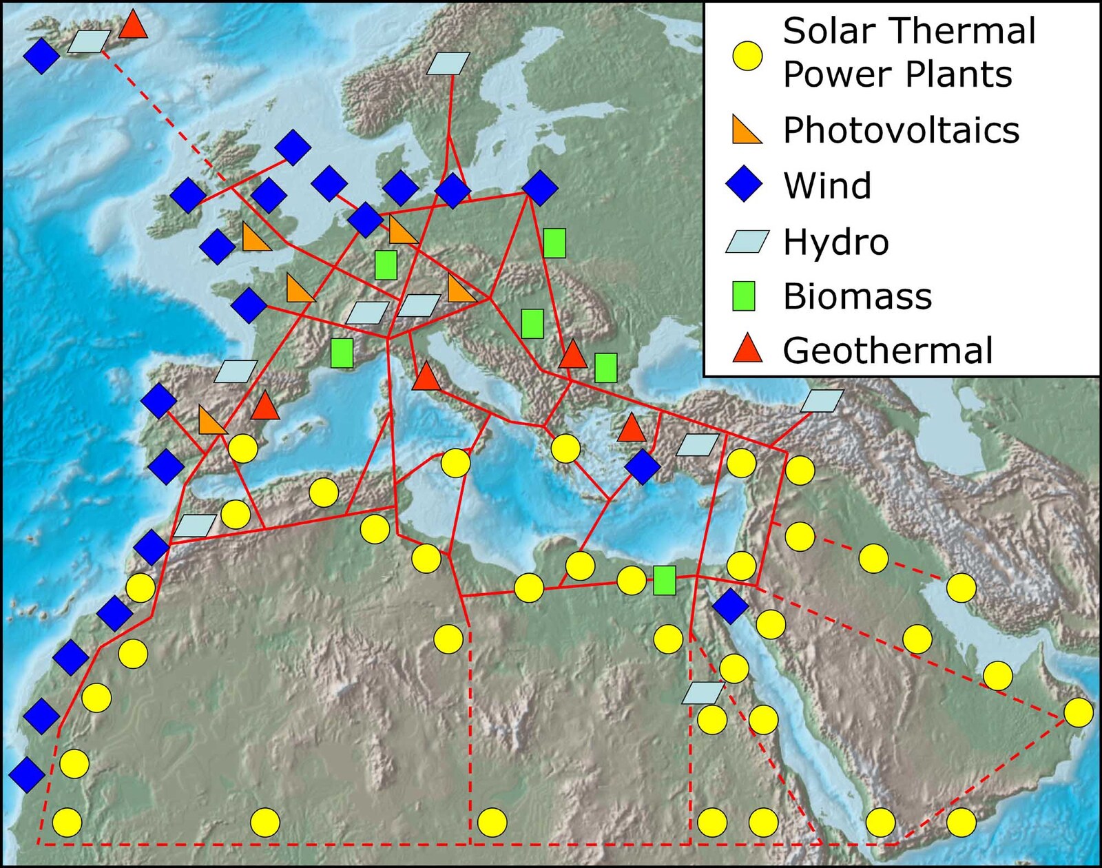
Image: TREC-Map-en
Size of this preview: 761 × 599 pixels. Other resolutions: 305 × 240 pixels | 2,000 × 1,575 pixels.
Original image (2,000 × 1,575 pixels, file size: 303 KB, MIME type: image/jpeg)
Description: Sketch of possible infrastructure for a sustainable supply of power to EUrope, the Middle East and North Africa (EU-MENA).
Title: TREC-Map-en
Credit: www.DESERTEC.org
Author: Trans-Mediterranean Renewable Energy Cooperation
Permission: http://www.trecers.net/press.html
Usage Terms: Creative Commons Attribution-Share Alike 2.5
License: CC BY-SA 2.5
License Link: https://creativecommons.org/licenses/by-sa/2.5
Attribution Required?: Yes
Image usage
The following page links to this image:

All content from Kiddle encyclopedia articles (including the article images and facts) can be freely used under Attribution-ShareAlike license, unless stated otherwise.