
Image: SwanseaMaliphantSidingsMap
Size of this preview: 711 × 600 pixels. Other resolutions: 285 × 240 pixels | 728 × 614 pixels.
Original image (728 × 614 pixels, file size: 749 KB, MIME type: image/png)
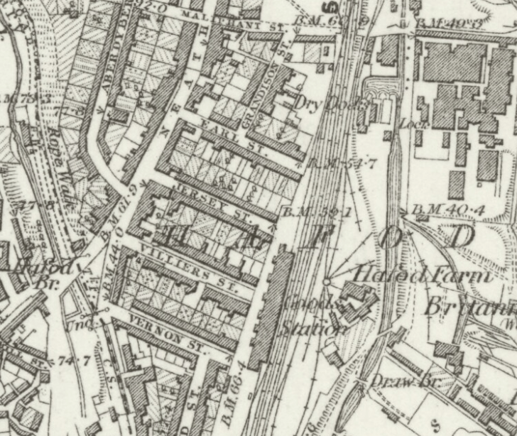
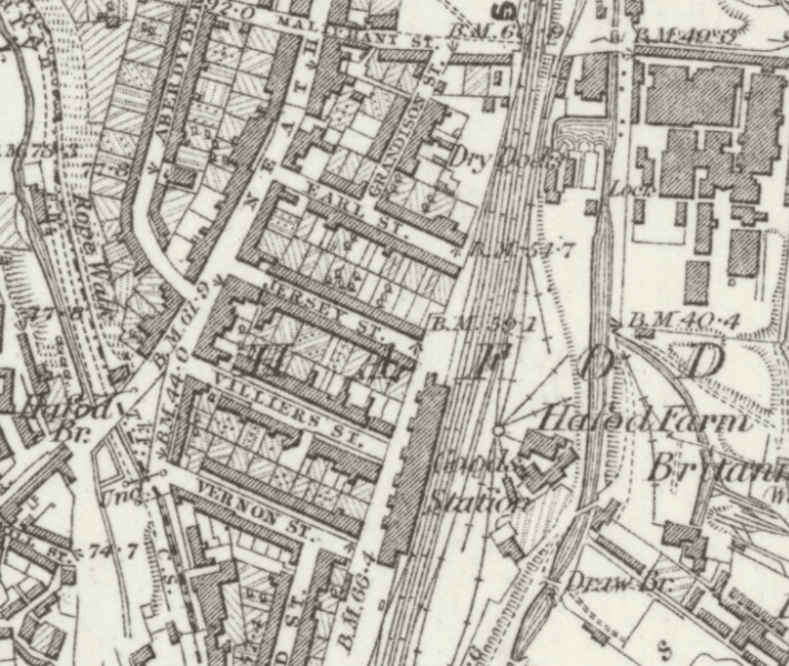
Description: Ordnance Survey map published in 1884, depicting an area of Swansea, Wales that lies south of Maliphant Street. The railway sidings and turntable of Maliphant Sidings are clearly seen adjacent to the goods station. Swansea High Street station is to the south of the mapped area.
Title: SwanseaMaliphantSidingsMap
Credit: http://maps.nls.uk/view/102342508
Author: UK Ordnance Survey (Digitised by National Library of Scotland)
Usage Terms: Public domain
License: Public domain
Attribution Required?: No
Image usage
The following page links to this image:

All content from Kiddle encyclopedia articles (including the article images and facts) can be freely used under Attribution-ShareAlike license, unless stated otherwise.