
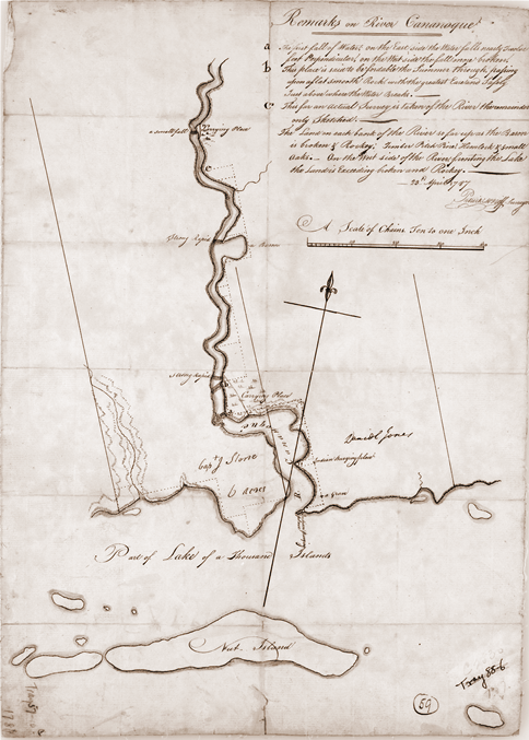
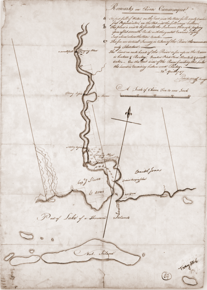
Image: Surveryor's map of Gananoque 1787
Size of this preview: 428 × 599 pixels. Other resolutions: 171 × 240 pixels | 484 × 677 pixels.
Original image (484 × 677 pixels, file size: 799 KB, MIME type: image/png)
Description: Surveryor's map of the Gananoque, Ontario region, showing private allotments and "Indian burial places".
Title: Surveryor's map of Gananoque 1787
Credit: http://www.colonelstone.ca/map1787.html "courtesy of the National Archives of Canada"
Author: Patrick McNiff, government surveyor for Upper Canada
Permission: PD
Usage Terms: Public domain
License: Public domain
Attribution Required?: No
Image usage
The following page links to this image:

All content from Kiddle encyclopedia articles (including the article images and facts) can be freely used under Attribution-ShareAlike license, unless stated otherwise.